
About Vík í Mýrdal
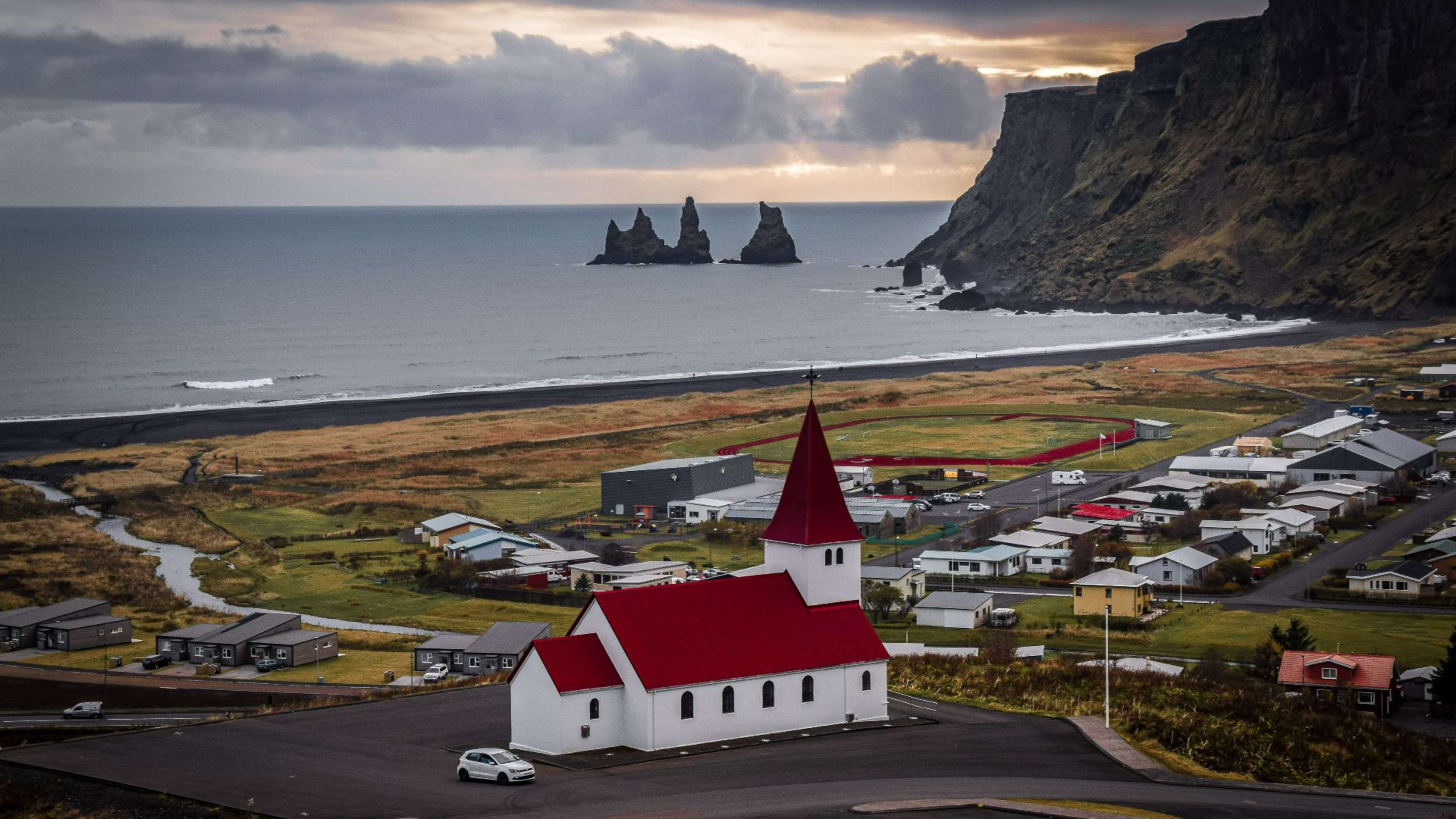
Vík í Mýrdal is a small village on the south coast of Iceland, roughly 187 km southeast of Reykjavík along Route 1. With a population of around 300, it is the southernmost inhabited place on the Icelandic mainland and one of the wettest settlements in the country. Most visitors passing through the south coast stop here, and with good reason -- the surrounding landscape is among the most varied and dramatic of any small area in Iceland.
To the north, Katla volcano sits beneath the Mýrdalsjökull glacier. Katla is one of the most closely monitored volcanoes in Iceland and its last major eruption was in 1918. To the south, the coastline drops to black basalt cliffs and the wide Reynisfjara beach. The village sits between these two geological forces, which gives it an unusually intense character for somewhere so small.
What to see near Vík
Reynisfjara
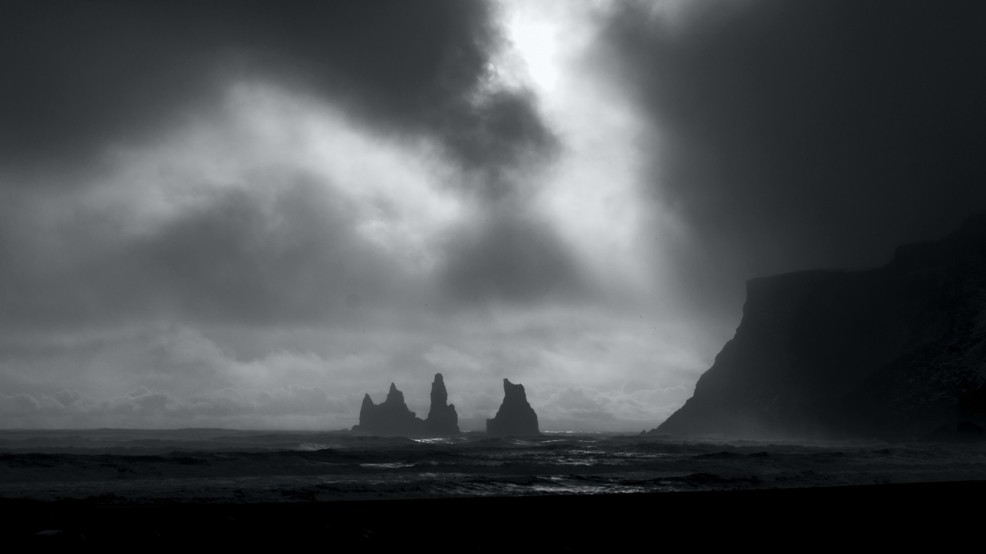
About five minutes by car from the village centre, Reynisfjara is one of the most visited beaches in Iceland. The sand is jet black, ground from volcanic basalt, and the beach is flanked to the east by the Reynisdrangar sea stacks -- three basalt columns rising from the ocean that feature in local folklore as trolls turned to stone by the dawn. To the west, the cliffside has formed into distinctive hexagonal basalt columns that create a cave-like overhang at the base of the rocks.
The surf at Reynisfjara is strong and the waves here are genuinely dangerous. Rogue waves have injured and killed visitors who have walked too close to the water. The beach is well signed with warnings and there is a clear safe zone marked -- stay well back from the shoreline regardless of how calm conditions appear.
Dyrhólaey
About 20 minutes west of Vík, the Dyrhólaey promontory is a 120-metre headland with a natural rock arch at sea level and a lighthouse at the top. During the summer nesting season from mid-May to mid-August, puffins nest on the cliff ledges here in large numbers. The viewpoint from the lighthouse road gives a long stretch of coastline in both directions. Access to the tip of the headland is sometimes restricted during the nesting season to protect the birds.
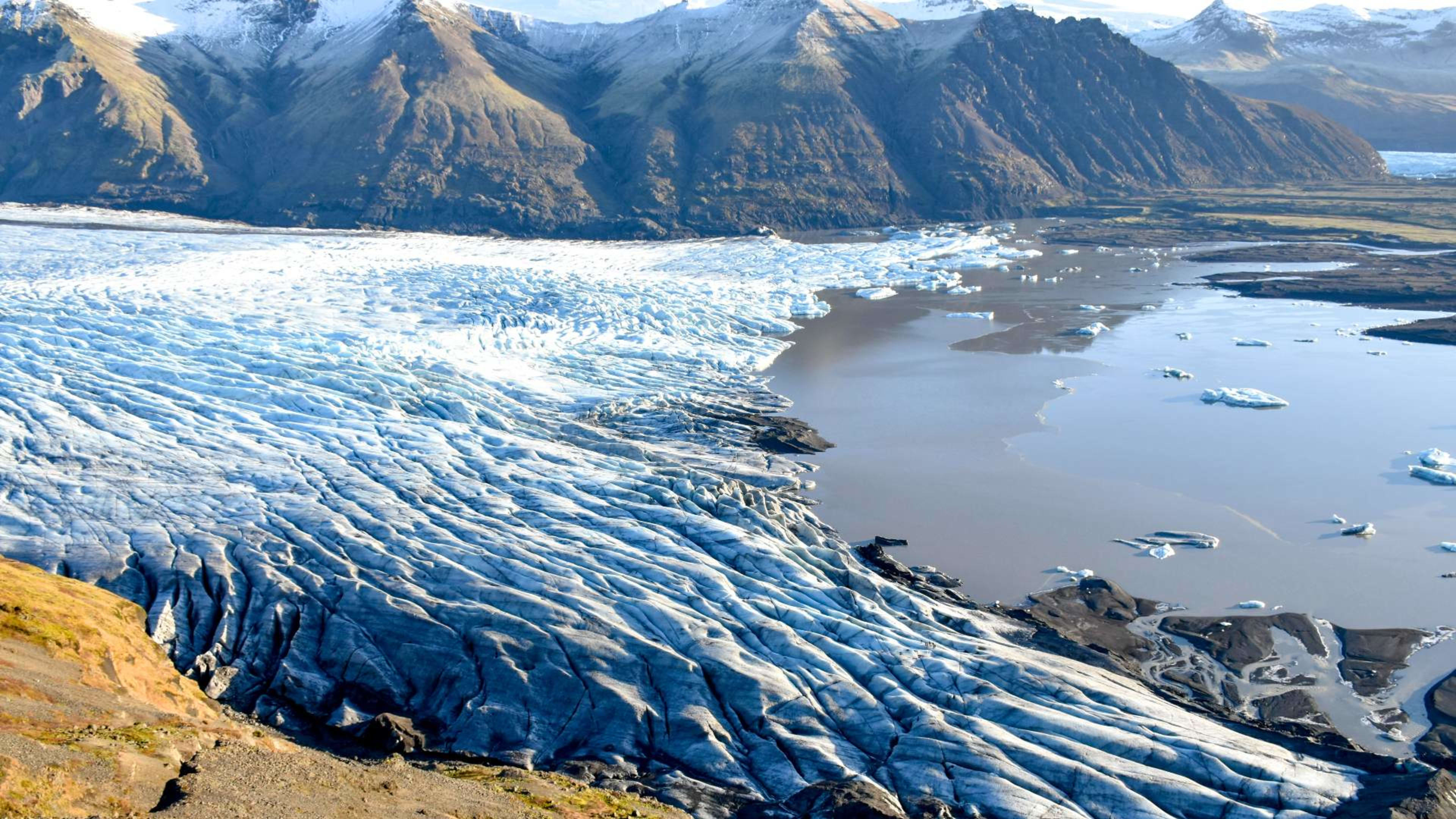
Sólheimajökull
Around 30 minutes west of Vík, the Sólheimajökull glacier tongue descends from the Mýrdalsjökull ice cap to a terminal lagoon at accessible walking distance from the car park. Glacier hikes departing from here are run by local operators throughout most of the year. The glacier has retreated significantly over recent decades, and the lagoon has grown noticeably larger as a result.
Vík as a stop on the South Coast
Vík is the natural overnight stop midway along the South Coast route from Reykjavík east toward Jökulsárlón glacier lagoon. It has the most complete services of any village in the area, including restaurants, a supermarket, petrol, and a range of accommodation. On a South Coast self-drive, most itineraries place the first night in or around Vík after a day that takes in Seljalandsfoss and Skógafoss on the way east.
Our 4-day South Iceland self-drive and 5-day South Iceland and Blue Lagoon tour both pass through the Vík area and include time at Reynisfjara. It also features on our longer Ring Road itineraries as a scheduled overnight stop heading clockwise around the island.
When to visit
Vík is accessible year-round and each season offers something different. Summer brings long daylight hours and access to the puffin colonies at Dyrhólaey, as well as the best conditions for glacier hiking on Sólheimajökull. Winter brings the possibility of seeing the Northern Lights from the area around the village, and guided ice cave tours operate on the Katla glacier from October through March. The shoulder months of May and September tend to be quieter without being significantly worse in terms of weather or access.