
Skógafoss

Marvel at the beauty of one of Iceland’s most iconic waterfalls.

South Iceland

About Skógafoss

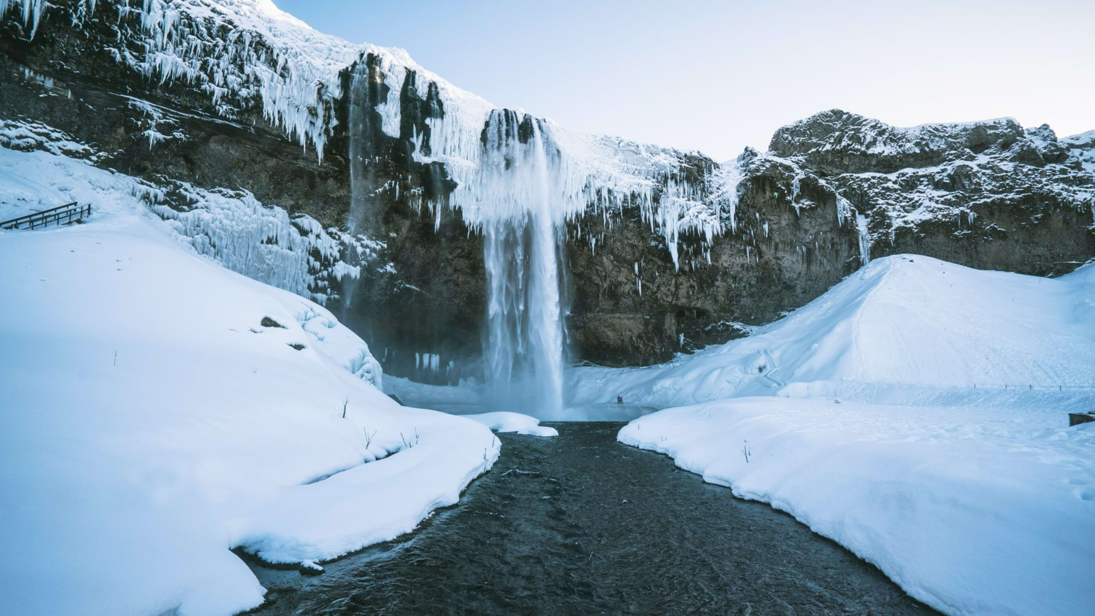
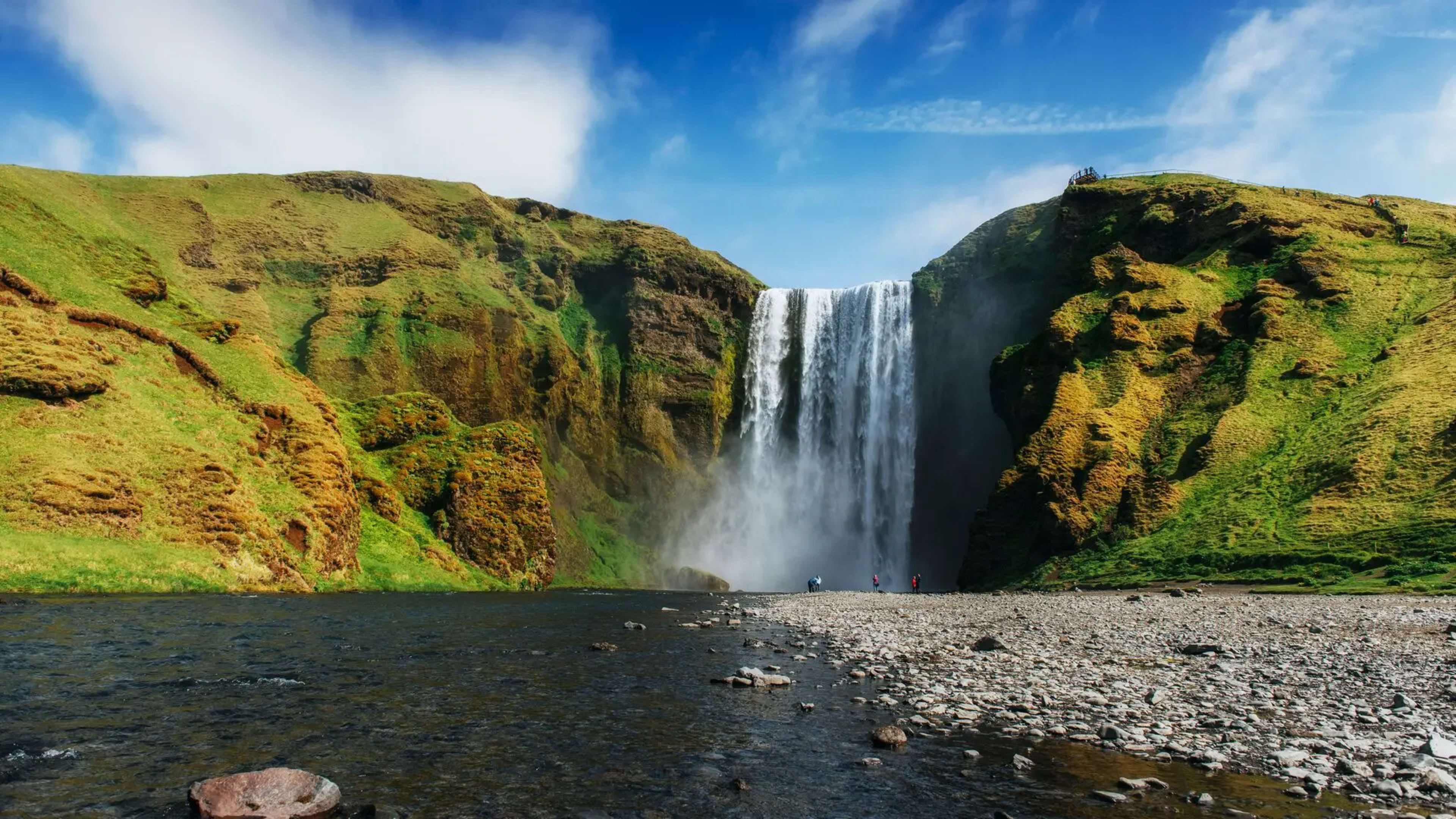
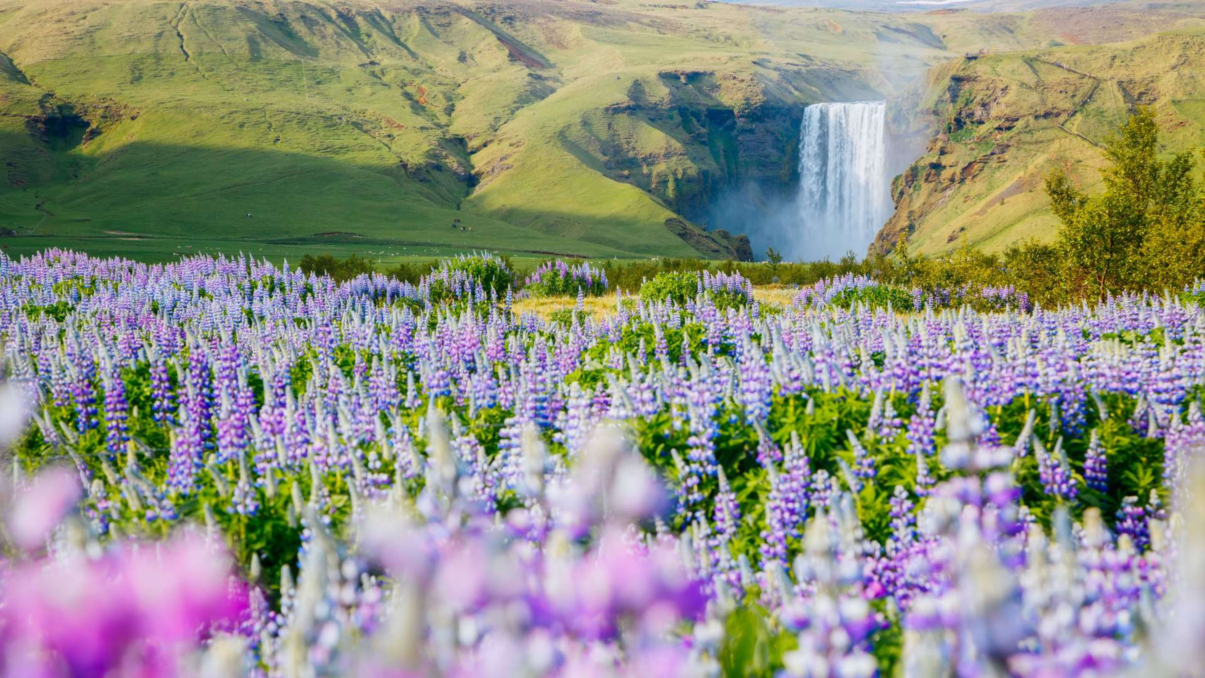
Skógafoss is a 60-metre waterfall on the Skógá river in south Iceland, about 156 km southeast of Reykjavík -- roughly two hours by car along Route 1. At 25 metres wide, it has an unusually broad face for its height, which gives it the appearance of a solid wall of water rather than a narrow plunge. On sunny days, the mist from the base produces near-constant rainbows.

The waterfall sits at what was once Iceland's Atlantic coastline. At the end of the last Ice Age, the glaciers melted and the land gradually rose as the weight of the ice lifted -- a process called post-glacial rebound. This caused the shoreline to recede around 5 km inland, leaving the cliffs that now form the backdrop to the falls.

Visiting Skógafoss

The waterfall is directly off Route 1 with a large free car park at the base. From there it is a short, flat walk to the foot of the falls. You cannot walk behind Skógafoss as you can at Seljalandsfoss, but the base viewpoint is impressive and the spray reaches you well before you get close to the water. Wear waterproof layers and watch your footing on the rocks.

A staircase on the eastern side of the falls climbs around 400 steps to a viewing platform at the top, where the river stretches away into the surrounding hills. The views from the top take in a wide section of the south coast and are worth the climb if conditions allow. The path continues beyond the top of the falls as part of the Fimmvörðuháls hiking trail, which leads toward the highlands and eventually connects with the Laugavegur trail.

Plan for one to two hours if you want to walk to the base, climb to the top, and spend some time at each point. If you want to explore the trails further, you could easily fill a full day.

The folklore

Skógafoss has a well-known local legend attached to it. According to the story, Þrasi Þórólfsson, one of Iceland's early settlers, hid a chest of gold behind the waterfall. It was reportedly discovered centuries later, but the chest was so rotted that only the ring handle could be grasped before it fell apart and sank. The handle is said to have been kept on the door of the nearby Skógakirkja church for years. The Skógar Museum, a few minutes from the waterfall, holds a collection of artefacts from the region and is worth a visit if you have time.

Skógafoss on the south coast

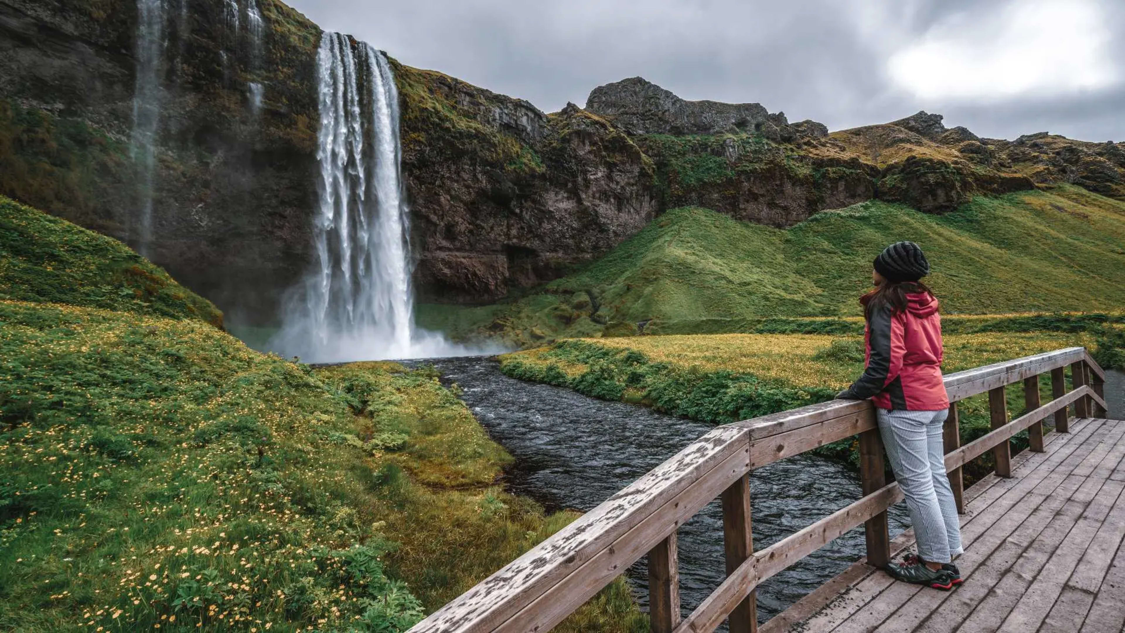
Skógafoss sits midway along the south coast route and combines naturally with the other major stops in the area. Seljalandsfoss is about 30 minutes to the west. Vík í Mýrdal and Reynisfjara black sand beach are roughly 30 minutes east. Jökulsárlón glacier lagoon is about three hours further east. Most south coast self-drive tours include Skógafoss as a standard stop, and it also appears on most Ring Road itineraries.

Other attractions near Skógafoss

The Seljalandsfoss waterfall covered in icicles

Seljalandsfoss

Walk behind a powerful plume of fresh glacier water at this wonderful waterfall.

30 km (19 mi)

View
Vik Church with Reynisdrangar sea stacks in the distance

Vík í Mýrdal

Discover Iceland’s wild south coast from this charming village.

34 km (21 mi)

View
Elephant Rock cliff in the Westman Islands

Westman Islands

The Westman Islands, known in Icelandic as Vestmannaeyjar, are a group of fifteen volcanic islands off Iceland's south coast. Only one, Heimaey, is inhabited, with a population of around 4,000. The islands are known for their dramatic cliffs, the world's largest Atlantic puffin colony, and the 1973 eruption of Eldfell volcano, which buried part of the town and reshaped the harbour. The ferry crossing from Landeyjahöfn on the mainland takes 35 minutes.

58 km (36 mi)

View
The village of Kirkjubæjarklaustur on a sunny day

Kirkjubæjarklaustur

Kirkjubæjarklaustur, commonly shortened to Klaustur, is a small village on Iceland's south coast along the Ring Road, roughly 250 kilometres east of Reykjavík. It sits within Katla Geopark and serves as a practical base for exploring the surrounding volcanic landscape.

107 km (66 mi)

View

FAQs about Skógafoss

Skógafoss is around 60 metres (197 feet) tall and 25 metres (82 feet) wide. The broad face gives it the appearance of a solid wall of water, and the volume of flow means the mist from the base reaches well out toward the viewing area on most days.

Skógafoss is on the Skógá river next to Skógar village in south Iceland, about 156 km southeast of Reykjavík along Route 1. It sits directly off the Ring Road with a free car park at the base, making it a straightforward stop on any south coast itinerary.

Skógafoss is around 156 km from Reykjavík, about a two-hour drive southeast along Route 1. The waterfall is directly off the Ring Road, so no significant detour is needed whether you are driving yourself or travelling as part of a guided tour.

Unlike Seljalandsfoss, there is no path behind Skógafoss. The base viewpoint is close to the falls and the spray reaches you well before you approach the water, so waterproof layers are worth wearing. A staircase on the eastern side climbs around 400 steps to a viewing platform at the top of the falls, with wide views over the surrounding south coast.

At the end of the last Ice Age, Skógafoss waterfall – which is fed by Skógá river – dropped directly into the sea. But since then, the ice has melted causing Iceland’s landmass to rise.

This meant that the ocean level receded over time. So when you visit Skógafoss today, the cliffs you’re looking at are an ancient coastline that’s approximately 5 kilometers (3 miles) inland.

One to two hours is enough to walk to the base, climb the steps to the top, and spend time at both viewpoints. If you plan to continue along the Fimmvörðuháls hiking trail beyond the top of the falls, allow considerably more time and come prepared with food, water, and appropriate footwear.

Yes, entry to Skógafoss is free and there is no charge to use the car park. If you arrive as part of a guided tour, the tour cost covers transport and guiding but there is no separate admission fee at the waterfall itself.

Skógafoss sits directly off Route 1, the Ring Road, about two hours southeast of Reykjavík. By car, follow Route 1 east until you see the waterfall and car park signposted on the left. The site is also included as a standard stop on most south coast self-drive and guided group tour itineraries.

#icelandmyway

See what travelers like you have been up to lately on Instagram.