Skaftafell and Vatnajökull National Park
Skaftafell is part of Vatnajökull National Park, Iceland's largest national park, which covers around 14% of the country and was designated a UNESCO World Heritage Site in 2019. The Skaftafell area was established as a national park in its own right in 1967 and became part of the larger Vatnajökull National Park when that was founded in 2008. The park as a whole extends north to encompass the Jökulsárgljúfur canyon system, the Askja caldera in the highlands, and the Snæfell area in the east.
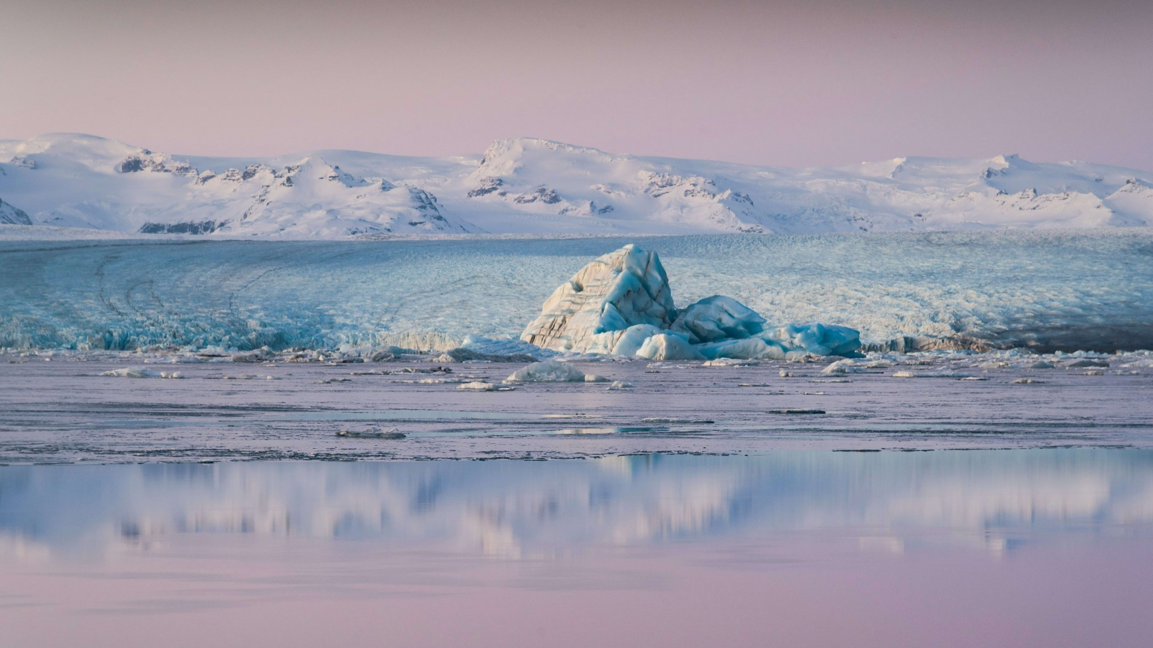
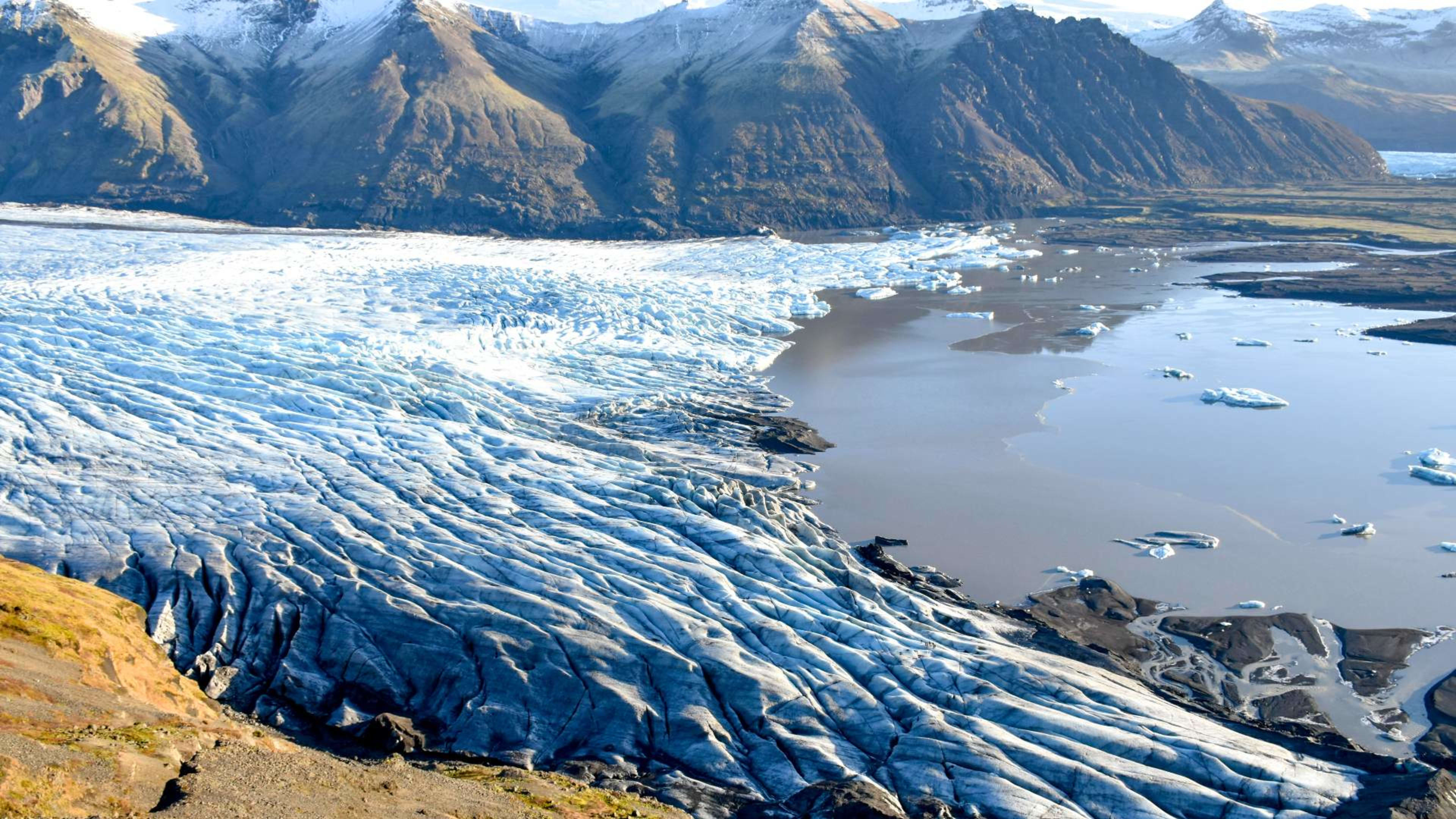
The landscape around Skaftafell is shaped by the meeting of glacial and volcanic forces. Outlet glaciers descend from the Vatnajökull ice cap, rivers of meltwater cross the lowland plains, and the sheltered position of the area creates a microclimate that supports birch woodland and lush ground cover unusual for this latitude. Iceland's tallest birch trees grow here, and the vegetation has long made Skaftafell distinct from the bleaker terrain that surrounds it on the south coast.
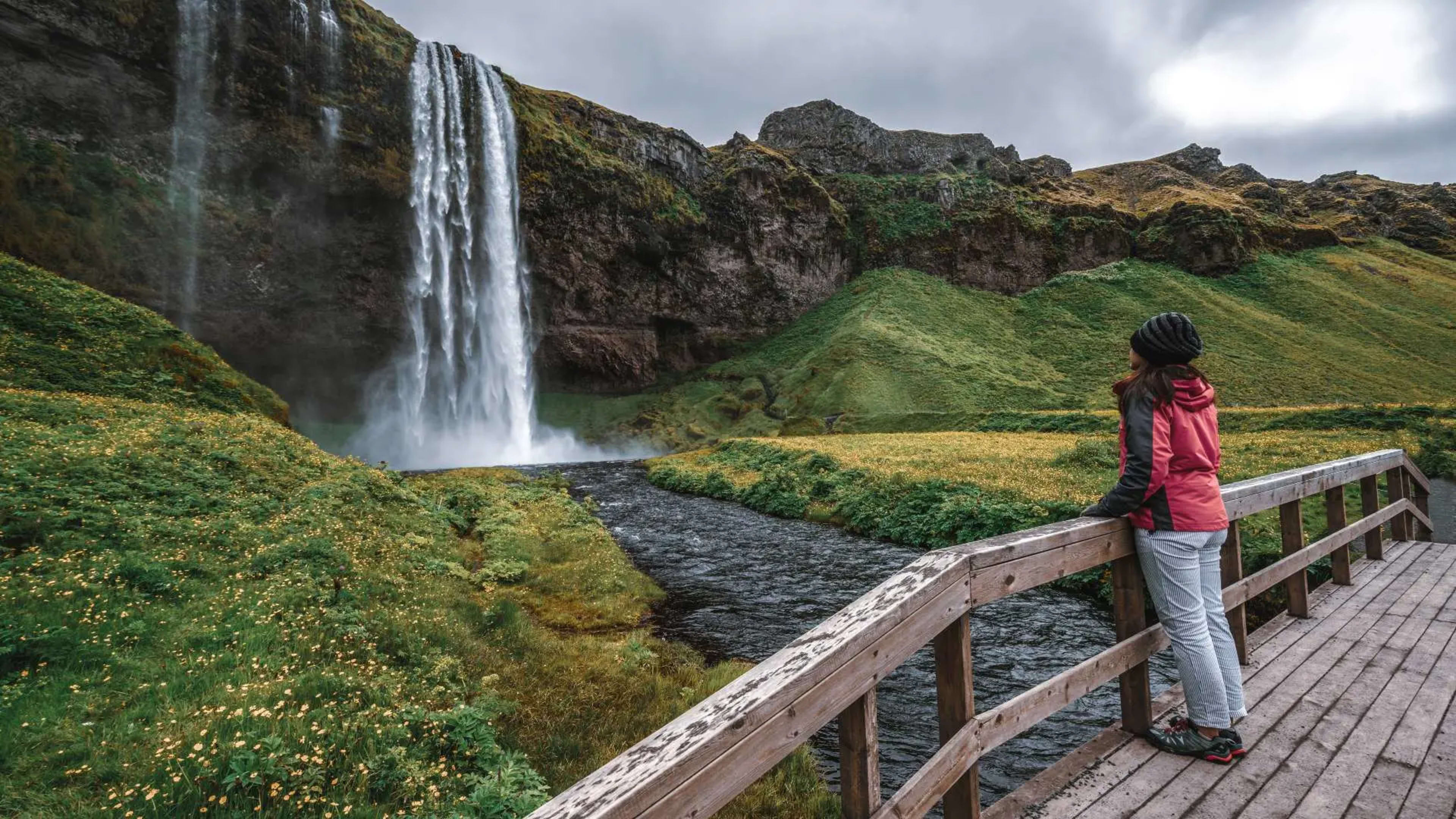
Svartifoss
Svartifoss is the most visited feature within the Skaftafell area. The waterfall drops roughly 20 metres and is framed on three sides by columns of dark basalt that fractured into regular hexagonal and pentagonal shapes as the lava cooled slowly over thousands of years. The same geometric forms influenced the architecture of Hallgrímskirkja in Reykjavík, which drew on Svartifoss as a direct design reference.
The trail from the visitor centre car park covers around 1.8 kilometres one way, gaining elevation steadily through open scrubland and birch cover before reaching the viewpoint above the falls. The round trip typically takes between 1.5 and 2 hours at a comfortable pace. A further path continues above the falls to the Sjónarsker viewpoint, which gives a broader perspective over the glaciers and the lowland plain below.
Hiking in Skaftafell
Trail network
Skaftafell has a well-maintained trail network with routes covering a range of distances and terrain. The visitor centre provides printed maps and current trail condition information, and rangers can advise on route selection based on fitness level and weather.
The Skaftafellsjökull glacier viewpoint is one of the shorter options, a 3.7 kilometre round trip on mostly flat ground that brings you to the edge of the outlet glacier. This is a practical choice for those with limited time or who want an accessible introduction to glacial terrain. Markers along the path indicate where the ice stood at various points in the past, and the retreat visible across recent decades is considerable.
For a more demanding day, the Kristínartindar ridgeline is the area's most challenging route. The trail climbs approximately 1,000 metres over around 7 kilometres to reach the peaks, from which views extend across the ice cap, the lowland sandur plains, and the coast. Only experienced hikers should attempt this route, and proper footwear, layered clothing, and sufficient food and water are essential.
The Morsárdalur valley provides a quieter alternative for those wanting a longer walk without the elevation demands of the ridge. The valley runs north of the main visitor area and sees fewer visitors than the Svartifoss trail, though it requires a full day if walked in its entirety.
Seasonal trail conditions
All main hiking trails are accessible from late May through September. Snow and ice can linger at higher elevations into early summer, and the Kristínartindar route in particular may require traction devices in May. In winter, trails above the valley floor are generally not suitable without specialist equipment, though the Svartifoss path is sometimes walkable on calm days with appropriate footwear.
Glacier activities
Skaftafell is the primary departure point for guided glacier walks on Falljökull and Skaftafellsjökull, two of the outlet glaciers descending from Vatnajökull. These tours are led by accredited local guides and operate year-round, with participants fitted with crampons, helmets, and ice axes at the trailhead. No prior glacier experience is required for the shorter introductory walks, which typically cover two to three hours on the ice.
More technical glacier climbing is available for those with experience, and multi-day expeditions onto the ice cap can be arranged through local operators in the area.
From November through March, Vatnajökull also hosts natural ice caves, accessible only during this window when temperatures are cold enough to stabilise the ice. These tours depart from Skaftafell and from other points further east. Availability depends on conditions each winter and should be booked well in advance.
Wildlife
The varied habitats in and around Skaftafell support a range of bird species. Wheatears, redwings, and snow buntings are common on and near the hiking trails during summer. Ravens are present year-round. Ptarmigan occupy the higher ground and change plumage from mottled brown in summer to near-white in winter. Gyrfalcons, Iceland's national bird, hunt across the open terrain and are occasionally seen from the upper trails.
Arctic foxes are present in Vatnajökull National Park, though sightings are not guaranteed. They are most active around dawn and dusk and are more likely to be encountered on quieter trails away from the main visitor areas. The national park has designated protection zones for denning sites, and disturbance of foxes or their dens is prohibited.
The visitor center
The Skaftafell visitor center is located at the main car park and serves as the starting point for most activities in the area. It holds exhibits on the geology, ecology, and history of the park, provides detailed trail maps, and has staff on hand to advise on conditions and activities. A small café operates from the centre during peak season. Toilet facilities are available, and an EV charging point is on site.
The parking fee applies to all vehicles and varies by size. Visitors arriving on organised tours typically have this cost included in their package.
Getting to Skaftafell
Skaftafell lies directly off Route 1, the Ring Road, approximately 327 kilometres east of Reykjavík. The drive takes around 4 to 4.5 hours under normal conditions, passing through Vík í Mýrdal and across the Skeiðarársandur glacial outwash plain before reaching the national park entrance.
Public bus services connect Skaftafell with Reykjavík and other south coast stops during summer, operated by Strætó and Reykjavík Excursions. Services are less frequent in winter and some routes are seasonal.
Skaftafell is a scheduled stop on Iceland Tours' 8-day and 10-day Ring Road self-drive itineraries, with time allocated for the Svartifoss hike and the glacier viewpoint before continuing east toward Jökulsárlón and an overnight stop in the Höfn area.
Where to stay
The campsite within the Skaftafell area is one of the most well-equipped in Iceland, with sheltered pitches, shower facilities, and direct access to the trailheads. It operates from approximately May to October, though exact dates vary by year.
Several guesthouses and small hotels operate within a short drive of the park entrance. Freysnes, about 10 minutes west, offers simple guesthouse accommodation, and Hótel Skaftafell at Freysnes provides more complete hotel facilities. Fosshotel Glacier Lagoon lies further east. Höfn í Hornafirði, around 80 kilometres to the east, is the nearest town with a full range of accommodation and services and makes a practical overnight base for exploring both Skaftafell and Jökulsárlón on the same itinerary.