Just over 11 percent of Iceland is covered by glaciers, making them one of the most visible features of the landscape. You can see them from the Ring Road, from the air, and in some cases from Reykjavík on a clear day. This guide covers where Iceland's main glaciers are, which ones are worth visiting, and what activities are available on and around them.
- Get up close to a glacier on one of these adventure tours of Iceland.
The Icelandic word for glacier is jökull, which appears in the name of almost every glacier in the country.
Where are the glaciers in Iceland?
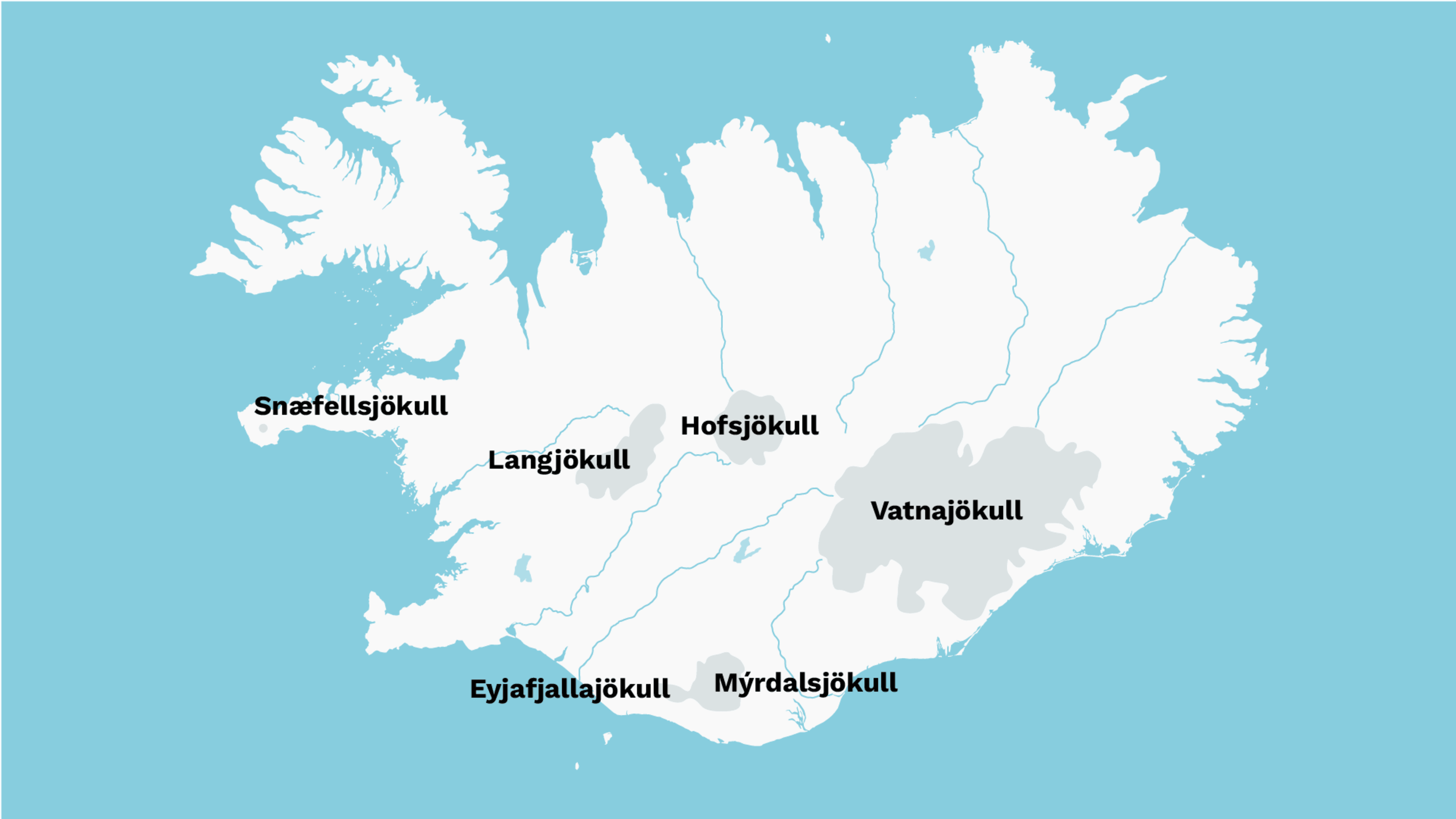
Most of Iceland's glaciers are concentrated in the southern half of the country, in a broad arc from the Snæfellsnes peninsula in the west to Vatnajökull in the southeast. The reason for this distribution is snowfall rather than temperature -- the south and centre of the country receive significantly more precipitation than the north.
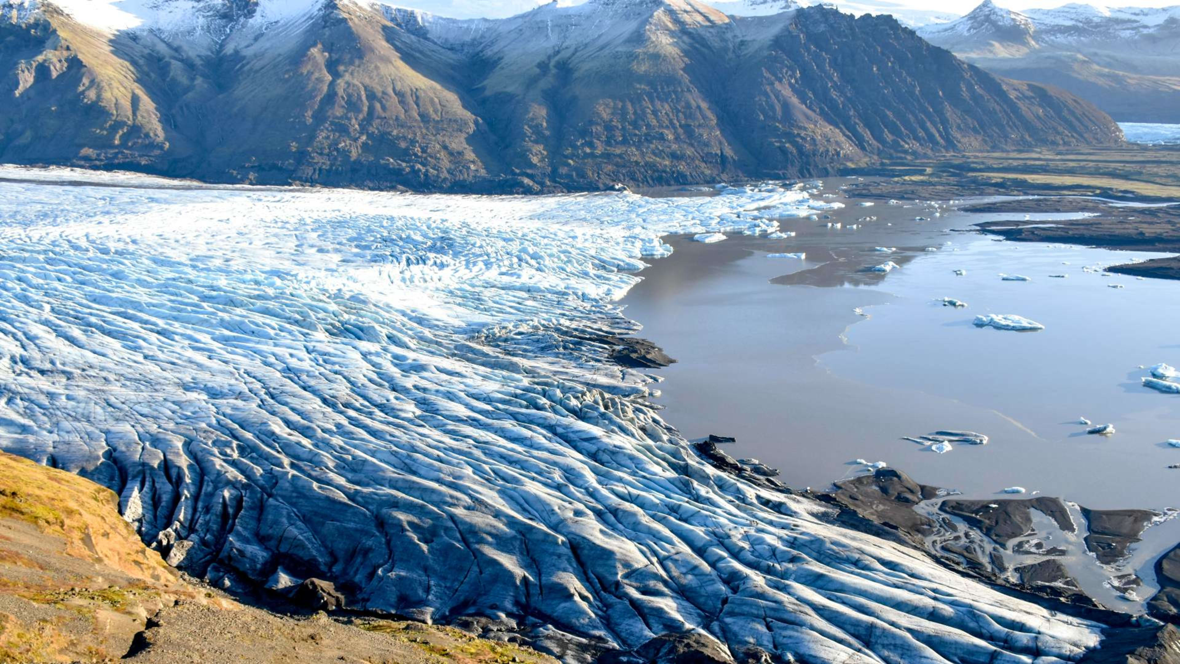
Vatnajökull, Iceland's largest glacier, stretches from the central highlands to the south coast. One of its outlet glaciers feeds Jökulsárlón glacier lagoon, where icebergs calve from the glacier face and drift toward the Atlantic.
The largest glacier in the north is Drangajökull in the Westfjords, which is also the fifth largest in the country overall.
How many glaciers are there in Iceland?
There are at least 13 named glaciers of significant size in Iceland, along with hundreds of smaller ice fields. In order of size from largest to smallest:
- Vatnajökull
- Langjökull
- Hofsjökull
- Mýrdalsjökull
- Drangajökull
- Eyjafjallajökull
- Tungnafellsjökull
- Þórisjökull
- Eiríksjökull
- Þrándarjökull
- Tindfjallajökull
- Torfajökull
- Snæfellsjökull
Iceland glacier map
You can see the main glaciers we’ll cover in this blog post on a map:
How much of Iceland is covered by glaciers?
Around 11,400 square kilometres (4,400 sq mi) of Iceland is covered by glaciers, which represents approximately 11 percent of the country's total land area. At the end of the last ice age, Iceland was almost entirely glaciated, with ice connecting the island to the Arctic. The glaciers visible today are what remains of that ice cap.
Are Iceland’s glaciers melting?
Yes. Iceland's glaciers are receding as a result of rising temperatures. Okjökull, one of the smallest, disappeared entirely in 2014 and was officially declared dead. The other major glaciers are all losing mass each year, though the rate varies between individual ice caps.
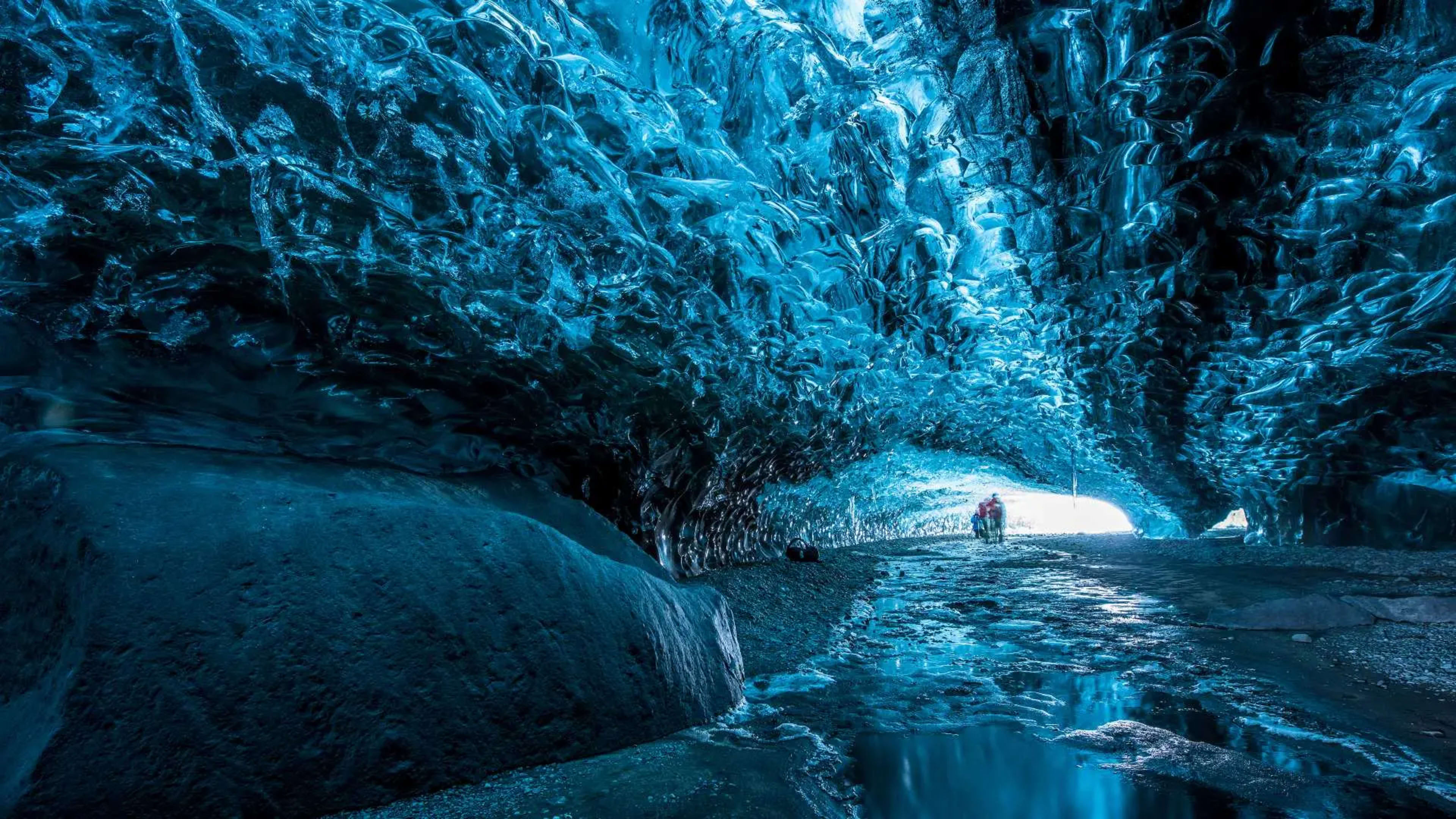
Seasonal melting is a normal part of the glacier cycle. In spring, meltwater carves ice caves beneath Langjökull and Vatnajökull. In winter the glaciers freeze solid and are topped up by snowfall, which compresses over years into new ice.
- Walk under a glacier yourself on an ice cave tour in Iceland.
- Related: Guide to ice caves and lava caves in Iceland.
Iceland's glaciers are also an important freshwater source, feeding many of the country's major waterfalls including Gullfoss, Seljalandsfoss, and Skógafoss. The volume of meltwater is most visible in summer when seasonal melting is at its peak.
Can I visit a glacier in Iceland?
Yes, but you should not attempt to walk on a glacier without a qualified guide. The surface of a glacier changes constantly and there are hidden crevasses and unstable ice that are not visible to the untrained eye. All reputable glacier walk tours are led by certified guides who provide the necessary equipment including crampons, harnesses, and helmets.
Viewing a glacier from a car park or walking path does not require a guide. Sólheimajökull, Skaftafellsjökull, and the Jökulsárlón lagoon area are all accessible without a guide from marked paths.
Best glaciers to visit in Iceland
1. Vatnajökull
Area: 7,900 km² (3,050 sq mi)
Location: Southeast Iceland
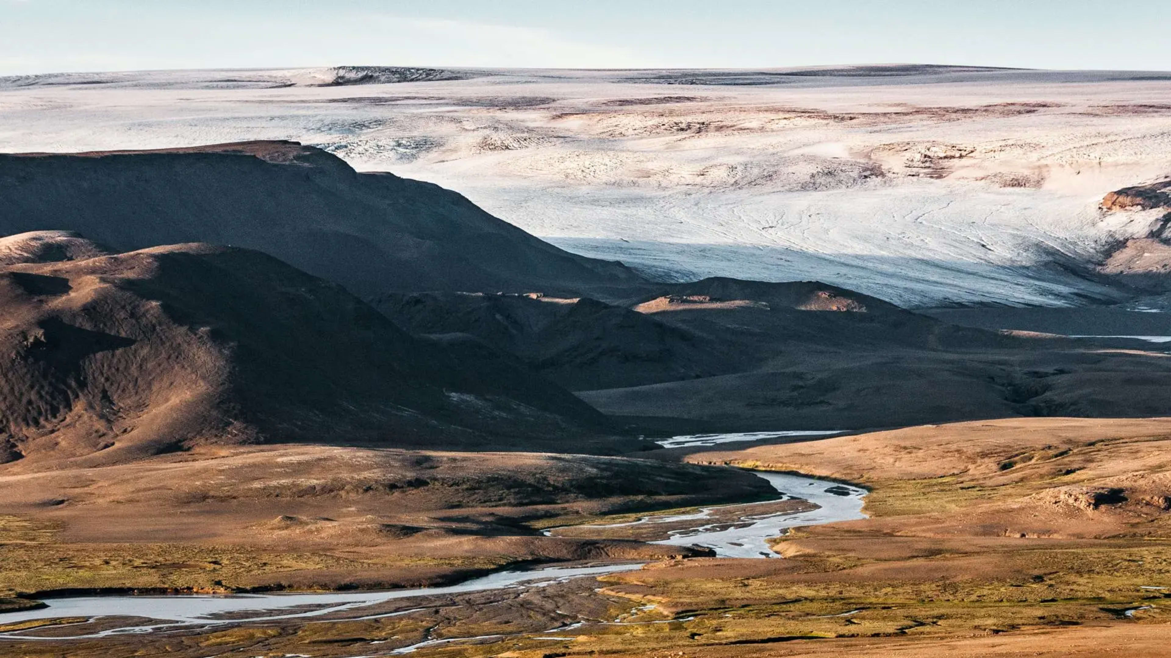
Vatnajökull is the largest glacier in Iceland and one of the largest in Europe, covering around 8 percent of the country on its own. It is also a national park, designated a UNESCO World Heritage Site in 2019. The glacier sits above several active volcanoes including Grímsvötn (last eruption 2011), Bárðarbunga (last major eruption 2014-15), and Öræfajökull (last eruption 1728).
The most accessible part of Vatnajökull for most visitors is the Skaftafell area on the southwestern edge, which has year-round glacier walks on Skaftafellsjökull and winter ice cave tours inside the glacier. The Breiðamerkurjökull outlet glacier feeds directly into Jökulsárlón glacier lagoon, where boat tours operate between May and October.
Jökulsárlón glacier lagoon
The Vatnajökull ice cap has dozens of valley glaciers that empty into different rivers. One of the most important is Breiðamerkurjökull, which stretches into the Jökulsárlón lagoon. This glacial lake is teeming with icebergs large and small that have broken off the glacier.
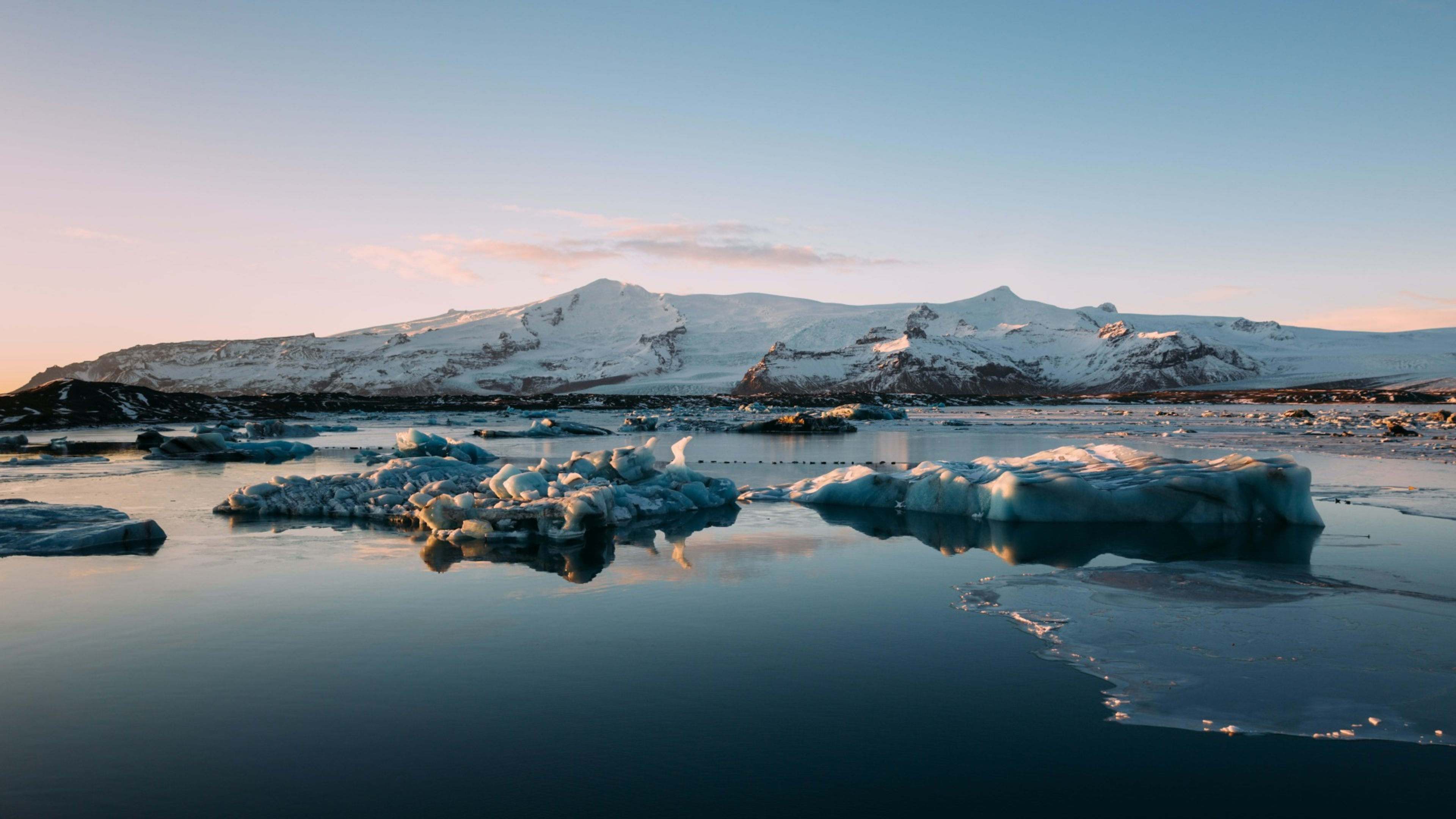
You can access Jökulsárlón easily from the Ring Road, which actually passes over the lagoon via a bridge. And because the lagoon connects to the North Atlantic, you can watch the icebergs drift out to sea from here.
- Why not set off on an Iceland Ring Road trip of your own?
- Blog: Ultimate guide to driving Iceland’s Ring Road.
Some icebergs are even washed ashore on the nearby Fellsfjara (aka Diamond Beach). This creates a magical effect as the blue ice contrasts with the pitch-black volcanic sand.
2. Mýrdalsjökull
Area: 560 km² (215 sq mi)
Location: South Iceland
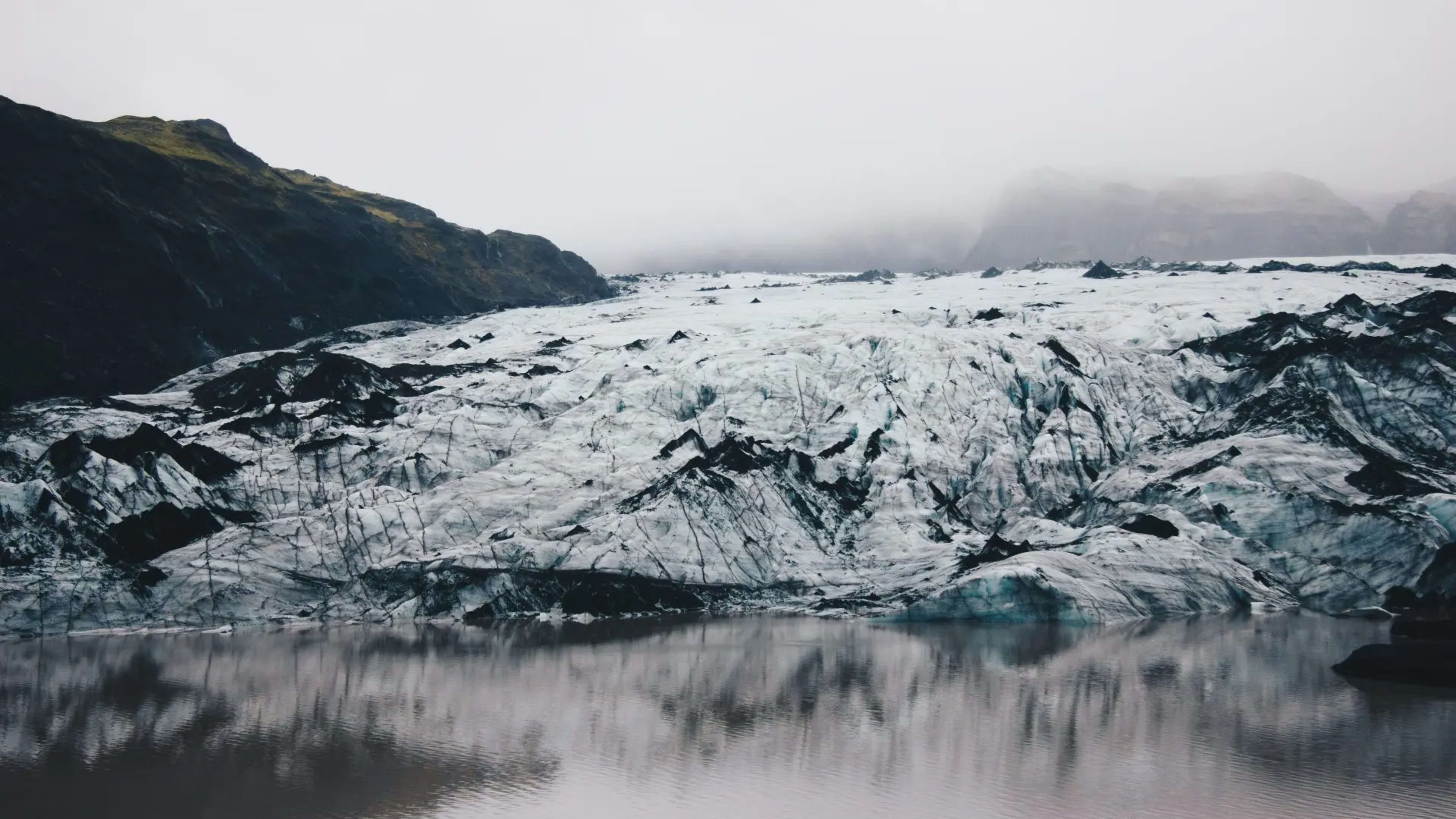
Mýrdalsjökull is the southernmost glacier in Iceland, located near the village of Vík. It covers Katla, one of Iceland's most closely monitored volcanoes. Katla last erupted significantly in 1918 and is considered overdue for another eruption.
Layers of volcanic ash are visible inside ice caves on the glacier, providing a record of past eruptions.The Sólheimajökull outlet of Mýrdalsjökull is one of the most popular glacier walk destinations in Iceland, accessible from a short walk from the car park on Route 1. Glacier walks and ice climbing tours operate year-round on Sólheimajökull.
- Take a multi-day tour from Reykjavík and join the fun on Mýrdalsjökull.
3. Langjökull
Area: 900 km² (350 sq mi)
Location: West Iceland
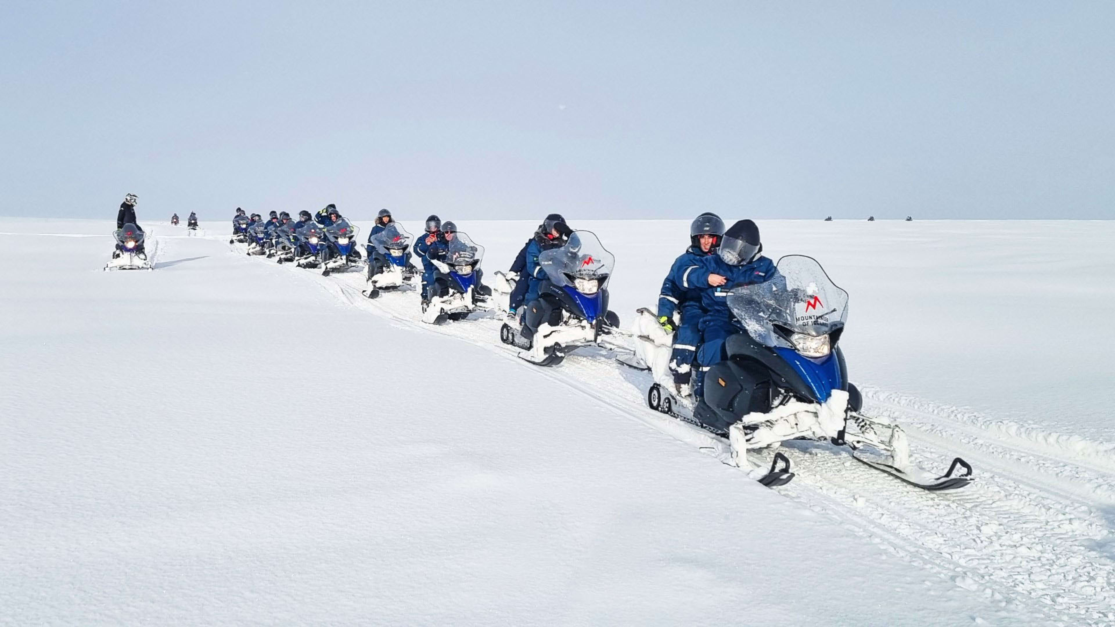
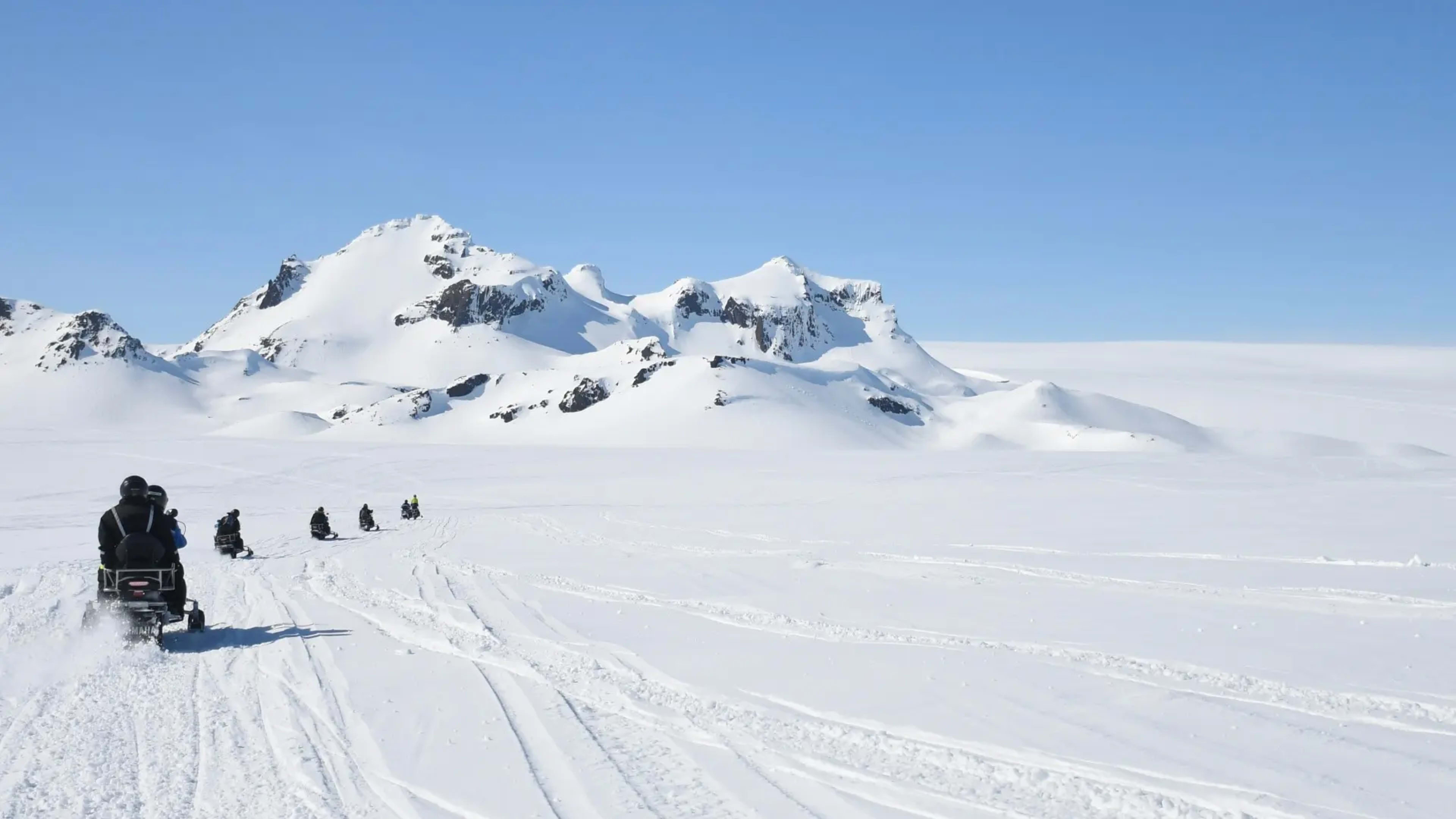
Langjökull, meaning Long Glacier, is the second largest glacier in Iceland and one of the most accessible for activities. From Gullfoss waterfall on the Golden Circle, the glacier is visible in the distance to the north. Snowmobiling, glacier hikes, and glacier jeep tours all operate on Langjökull. A man-made ice tunnel system inside the glacier is also open to guided tours.
- Check out these day trips for a full selection of ice-focused adventures.
4. Eyjafjallajökull

Area: 78 km² (30 sq mi)
Location: South Iceland
Eyjafjallajökull became internationally known when the volcano beneath it erupted in 2010, producing an ash cloud that disrupted European air travel for several weeks. The glacier is visible from the Ring Road south of Seljalandsfoss and on clear days from the Westman Islands. It is connected to the neighbouring Mýrdalsjökull by the Fimmvörðuháls mountain pass, which was one of the eruption sites in 2010.
A rough pronunciation guide: EY-ya-fyat-la-yoekut-l.
- See Eyjafjallajökull and more on a self-drive trip to Iceland.
- Get the lowdown on Iceland’s volcanoes with this guide.
5. Snæfellsjökull

Area: 11 km² (4 sq mi)
Location: Snæfellsnes peninsula, West Iceland
Snæfellsjökull is the smallest of Iceland's main glaciers but one of the most recognisable. It sits at the tip of the Snæfellsnes peninsula within its own national park and caps a volcano that last erupted around 2,000 years ago. The glacier is visible from Reykjavík on clear days. It was the setting used by Jules Verne in Journey to the Centre of the Earth as the entry point to the underground world.
Hiking on the mountain below the glacier is possible in summer with a guide. Walking on the glacier itself requires a certified glacier guide.
6. Hofsjökull
Area: 890 km² (345 sq mi)
Location: Central highlands
Hofsjökull is Iceland's third largest glacier, located in the central highlands. It sits above a large volcanic system with no confirmed eruption date in recorded history. The glacier is only accessible in summer when the highland F-roads are open, typically from mid-June to early September. A 4x4 is required for all highland routes.
The Kjölur road, which runs from south to north through the highlands, passes close to Hofsjökull and is one of the more accessible highland routes for visitors.
Planning your Iceland glacier trip
Most glacier activities in Iceland require joining a guided tour. Iceland Tours packages include glacier walk and ice cave options as add-ons at checkout, or as part of adventure-focused itineraries that cover the main glacier regions.
Self-drive tours that follow the Ring Road pass close to Vatnajökull, Eyjafjallajökull, and Mýrdalsjökull. The Golden Circle and Snæfellsnes peninsula tours pass within view of Langjökull and Snæfellsjökull respectively.
A 5% deposit secures your booking on all Iceland Tours packages.
FAQs about glaciers in Iceland
These questions cover the most common queries about visiting glaciers in Iceland, including safety, activities, and the best time to go.
Viewing a glacier from a marked path or car park is safe for most visitors. Walking on the ice surface is only safe with a certified glacier guide who provides appropriate equipment including crampons, helmets, and harnesses. The surface of a glacier changes constantly and hidden crevasses make it dangerous to walk on without a guide.
Vatnajökull is the largest and has the most activity options, including glacier walks at Skaftafell, ice cave tours in winter, and boat tours on Jökulsárlón glacier lagoon. Sólheimajökull on Mýrdalsjökull is the most accessible from Reykjavík and is a popular year-round glacier walk destination. Langjökull is the best option for snowmobiling and the man-made ice tunnel experience.
Glacier walks and snowmobiling are available year-round on most of the main glaciers. Ice caves inside Vatnajökull are only accessible in winter, typically from November to March, when the ice is stable enough for guided tours. Summer gives the best visibility and the most stable road conditions for reaching the glaciers.
Around 11 percent of Iceland's total land area is covered by glaciers, equivalent to approximately 11,400 square kilometres. Vatnajökull alone covers around 8 percent of the country.
Yes. Iceland's glaciers are losing mass each year as a result of rising temperatures. Several smaller glaciers have already disappeared. The larger ice caps including Vatnajökull and Langjökull are receding but remain substantial and accessible to visitors.
Yes. Several glaciers are visible directly from Route 1. Vatnajökull dominates the skyline along the southeast coast. Eyjafjallajökull and Mýrdalsjökull are visible from the south coast section. Snæfellsjökull is visible on clear days from the western end of the Ring Road and from Reykjavík.