Þórsmörk's Premier Viewpoint
Valahnúkur rises 458 meters (1,503 feet) above sea level in the heart of Þórsmörk valley, its summit offering what many consider to be one of the most spectacular 360-degree panoramic views in all of Iceland. This relatively modest peak punches far above its weight in terms of visual impact, providing perspectives that encompass glaciers, mountains, valleys, and braided rivers in every direction. The mountain towers above the Volcano Huts in Húsadalur, making it an unmissable landmark for anyone visiting this remote highland valley.
The name Valahnúkur should not be confused with cliffs of the same name on the Reykjanes Peninsula. The Þórsmörk Valahnúkur has earned its reputation through accessibility combined with extraordinary views, making it the most popular short hike in the valley. For hikers completing the demanding Laugavegur Trail from Landmannalaugar, climbing Valahnúkur on their final morning provides a triumphant conclusion to their journey, offering a chance to survey the landscape they have traversed over the previous days.
A Summit Worth the Climb
The hike to Valahnúkur's summit can be approached from either the Volcano Huts in Húsadalur or the Langidalur hut, with multiple trail options creating loops of varying lengths. The most direct route from Húsadalur covers approximately 2.4 kilometers to the summit, while the Langidalur approach is slightly shorter at 2.2 kilometers. Most hikers complete the ascent in about 90 minutes, though this can vary significantly depending on fitness level and how often they stop to admire the views.
The trail is well-marked with posts and signs, beginning with a short section through bushes and birch forest before emerging onto more open slopes. As the vegetation clears, the summit becomes visible and the path leading to the top is apparent on the mountainside. The climb is relatively steep in sections, but man-made steps cut into the steepest parts make the ascent more manageable. These thoughtfully placed steps prevent erosion while providing secure footing on otherwise challenging slopes.
The ascent gains approximately 220 to 300 meters of elevation depending on the starting point, a modest climb that feels more significant due to the steepness of certain sections. However, the trail never becomes technically difficult, remaining accessible to anyone with reasonable fitness and proper hiking boots. The relatively short distance and clear path make it possible for hikers of varying abilities to reach the summit and enjoy the views.
360 Degrees of Spectacular Views
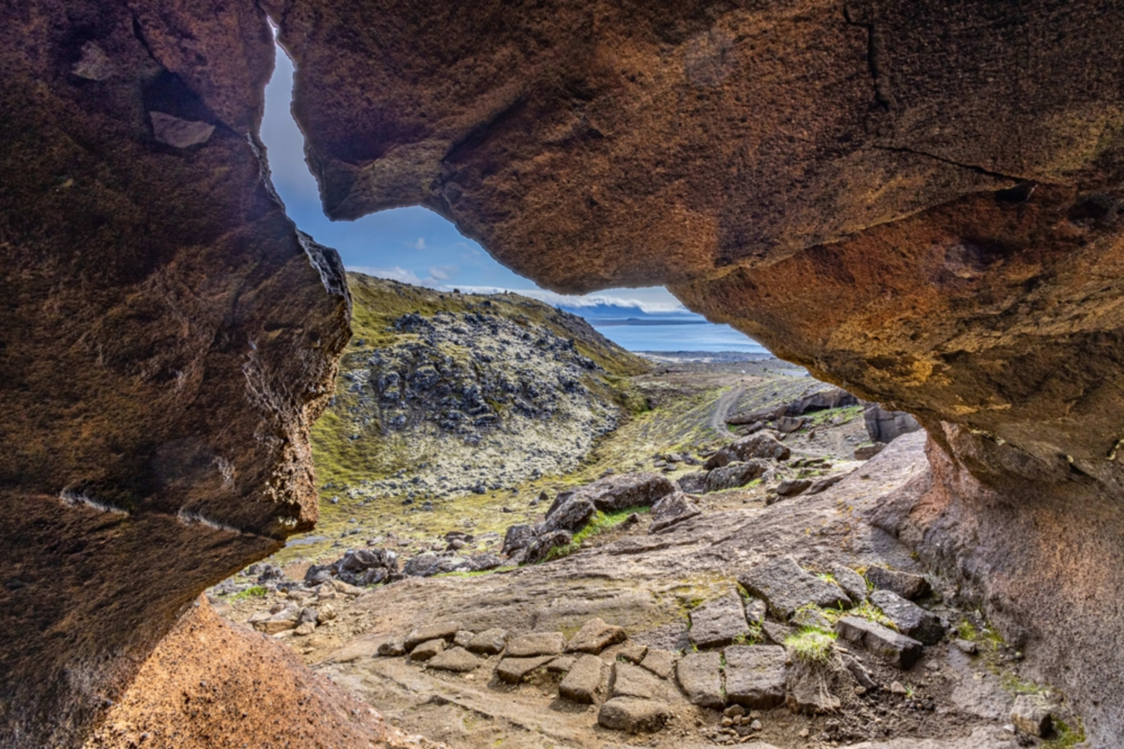
Upon reaching the summit, hikers are rewarded with an absolutely unique panoramic vista that extends for miles in every direction. An orientation table at the top helps visitors identify the various landmarks visible from this exceptional vantage point, though on clear days the major features are unmistakable.
To the south, the Krossá river cuts through the Þórsmörk valley at the foot of the Eyjafjallajökull glacier, its braided channels weaving through the landscape like silver ribbons. The massive white expanse of Eyjafjallajökull, famous for its 2010 eruption, dominates the southwestern horizon. To the southeast, the even larger Mýrdalsjökull ice cap fills the view, its smooth surface hiding the dangerous Katla volcano beneath.
Looking west, the lush Merkurrani plateau spreads out below, its green moss-covered cliffs contrasting dramatically with the glacial ice visible beyond. To the north, the Markarfljót river meanders through the highlands, its channels constantly shifting across the volcanic plains. The Tindfjöll mountains rise on the northwestern horizon, completing the circle of peaks and glaciers that surround Þórsmörk.
The interplay of landscape features creates a visual feast. Green valleys filled with birch forest nestle between black volcanic sands. White glaciers flow down from ice-capped peaks. Gray-brown braided rivers spread across outwash plains. The contrast between these elements, combined with the ever-changing light conditions typical of Iceland, means the view from Valahnúkur never looks exactly the same twice.
A Photographer's Paradise
Photographers particularly appreciate Valahnúkur for the compositional possibilities offered by the summit views. The 360-degree panorama means that compelling images can be captured in every direction, with the wide vistas lending themselves to ultra-wide-angle lenses while distant glacial details reward telephoto work. The elevation provides perfect perspectives for capturing the scale of the landscape and the relationship between different features.
Light changes rapidly at this elevation and in this location. Fast-moving weather systems create dramatic shifts in lighting conditions, with sun breaking through clouds to illuminate specific valleys while leaving others in shadow. Photographers willing to spend time at the summit and wait for favorable light conditions often capture extraordinary images showcasing the full drama of Iceland's highland landscape.
The changing weather that can challenge hikers becomes an asset for photographers. Fog rolling through valleys, clouds swirling around glacial peaks, and shafts of sunlight breaking through storm systems create dynamic, ever-evolving scenes. Many visitors report hiking Valahnúkur multiple times during extended stays in Þórsmörk, finding that different weather and light conditions create entirely different experiences.
Part of Longer Loops
While Valahnúkur can be hiked as a simple out-and-back trail taking about 90 minutes round trip, most visitors incorporate the summit into longer loop trails that explore more of Þórsmörk's features. The Þórsmörk Panorama trail, a popular 4.2-kilometer loop taking under two hours, combines the summit climb with a circuit through birch forests and past other viewpoints.
The Þórsmörk Highlights trail, marked in red, creates a longer 5.4-kilometer loop with 494 meters of elevation gain, typically completed in 3.5 to 4 hours. This route takes hikers through varied terrain including dense woods, ridge walking with spectacular valley views, and eventually up to Valahnúkur's summit before descending back to the starting point. The trail connects with portions of the Laugavegur Trail, allowing hikers to experience sections of Iceland's most famous long-distance route as part of their summit hike.
The descent from Valahnúkur often passes by Sönghellir cave, the "Song Cave" known for its acoustic properties. This combination of summit panoramas and cave exploration provides a satisfying variety of experiences within a relatively short hike, making efficient use of time for those spending just a day or two in Þórsmörk.
A Final Morning Highlight
For many hikers completing the Laugavegur Trail, the final morning in Þórsmörk includes a climb up Valahnúkur before catching the afternoon bus back to Reykjavík. This provides a fitting conclusion to their multi-day journey, offering a chance to see the full sweep of landscape from Eyjafjallajökull and Mýrdalsjökull glaciers to the valleys and rivers that define the region.
The emotional impact of this final climb can be significant. After days of challenging hiking through exposed highlands, standing at Valahnúkur's summit and looking back across the landscape creates a powerful sense of accomplishment. Many hikers report feeling grateful for the journey they have completed and the remarkable environments they have passed through, with Valahnúkur's panoramic views providing a visual summary of Iceland's highland beauty.
The relatively gentle nature of the Valahnúkur hike, compared to the more demanding sections of the Laugavegur Trail, allows tired hikers to enjoy this final adventure without excessive strain. The well-marked trail and man-made steps accommodate even those whose legs are weary from days of trekking, ensuring that nearly everyone can access the summit views.
Visiting Valahnúkur
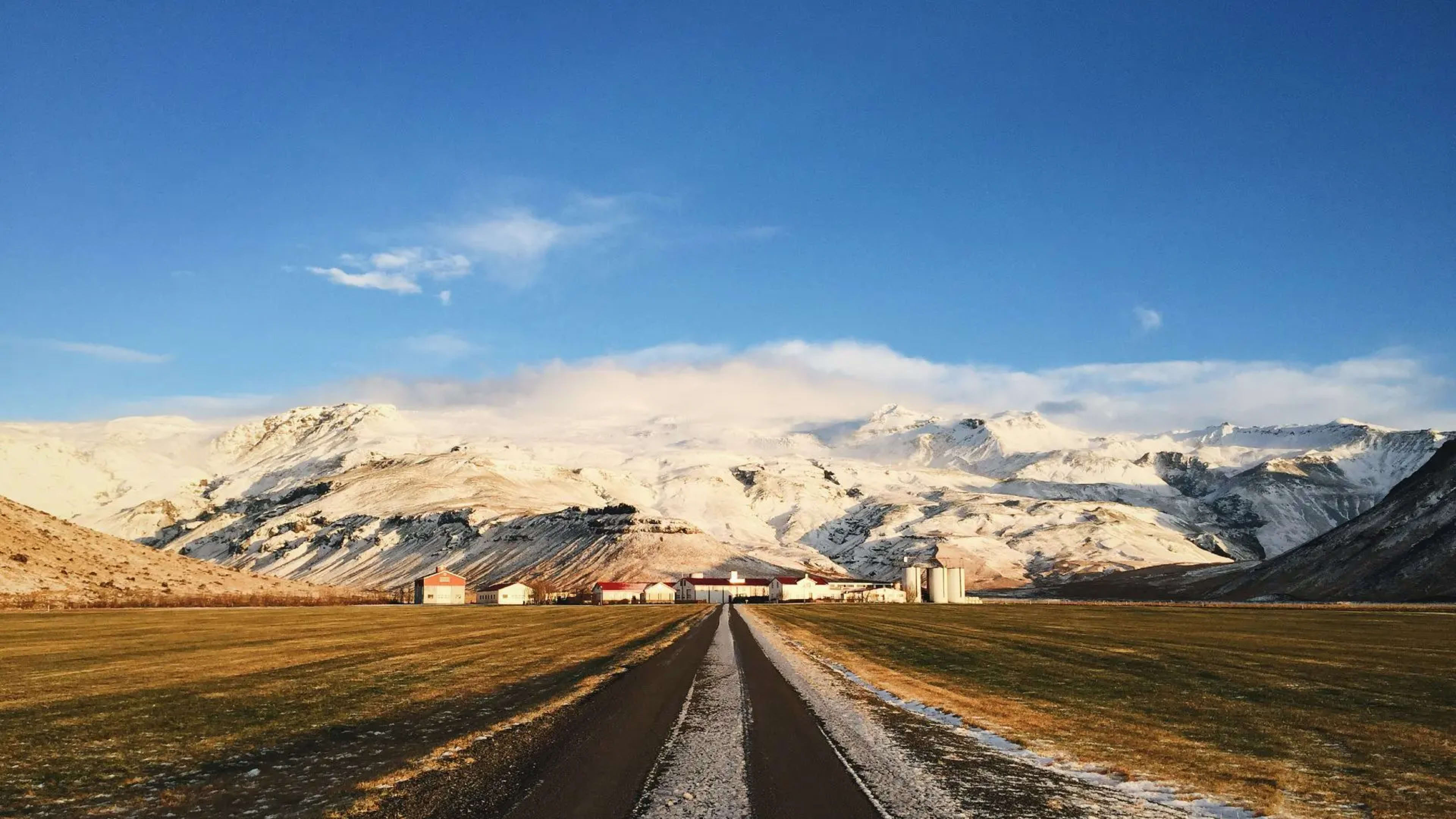
Access to Valahnúkur requires first reaching Þórsmörk valley, which itself is a significant undertaking. The valley is accessible via the challenging F249 road with its multiple river crossings, or more commonly via highland buses that operate during summer months. Most visitors base themselves at either the Volcano Huts in Húsadalur or the Langidalur hut, both serving as starting points for the Valahnúkur hike.
The best time to climb Valahnúkur is during summer, particularly July and August, when weather is most favorable and daylight extends well into evening. However, even during these months, conditions can change rapidly. Fog can engulf the summit within minutes, wind can make the exposed peak uncomfortable, and rain is common. Hikers should carry waterproof layers and be prepared for variable conditions.
Despite the potential for challenging weather, the summit remains accessible and worthwhile in less than perfect conditions. Even partial views through fog or clouds can be spectacular, and the experience of standing at the peak surrounded by swirling mist has its own atmospheric appeal. Many hikers report that their summit attempts in imperfect weather still provided memorable experiences, though those blessed with clear skies universally describe the views as breathtaking.