Thor's Forest in the Highlands
Þórsmörk, meaning "Thor's Wood" or "Valley of Thor," sits between three glaciers. This protected nature reserve lies between Eyjafjallajökull to the south and west, Tindfjallajökull to the north, and the massive Mýrdalsjökull to the east. Named after the Norse god of thunder, the valley sits within a protected nature reserve and is one of the more distinctive destinations in the Icelandic highlands.
The name refers specifically to a mountain ridge between the rivers Krossá, Þröngá, and Markarfljót, though it is commonly used to describe the wider area encompassing the valleys and slopes beneath the surrounding glaciers. Norse mythology tells that this valley was created when Thor's hammer, Mjölnir, struck the earth, forming the dramatic landscape that cuts through the region.
A Rare Green Oasis
What sets Þórsmörk apart from most of Iceland's highlands is its remarkable vegetation. The valley hosts some of Iceland's most extensive birch forests, a rarity in a country where only about 2 percent of land is forested. Arctic birch trees, primarily downy birch, thrive in the sheltered environment, creating woodlands that seem almost impossible given the harsh highland climate. These forests escaped the widespread deforestation that occurred when Iceland was first settled, making Þórsmörk a living connection to the island's pre-settlement landscape.
The protected position between glaciers creates an unusually warm microclimate, better than most of southern Iceland. Mountains rise around the valley like natural walls, blocking harsh winds and trapping moisture. This shelter allows not just birch trees but also a rich understory of dwarf willows, mosses, ferns, and flowering plants to flourish. The valley floor and hillsides are carpeted in vibrant green moss, creating landscapes that contrast spectacularly with the black volcanic sand and white glaciers that dominate views elsewhere in the highlands.
During summer, wildflowers add splashes of color to the already verdant landscape. Purple lupines, white moss campion, and yellow buttercups bloom across the volcanic soil, creating stunning visual contrasts against the dark sand. The abundance of vegetation supports wildlife that struggles to survive in harsher highland areas, including Arctic foxes, Iceland's only native land mammal, along with numerous bird species that make Þórsmörk their summer home.
A Hiking Paradise
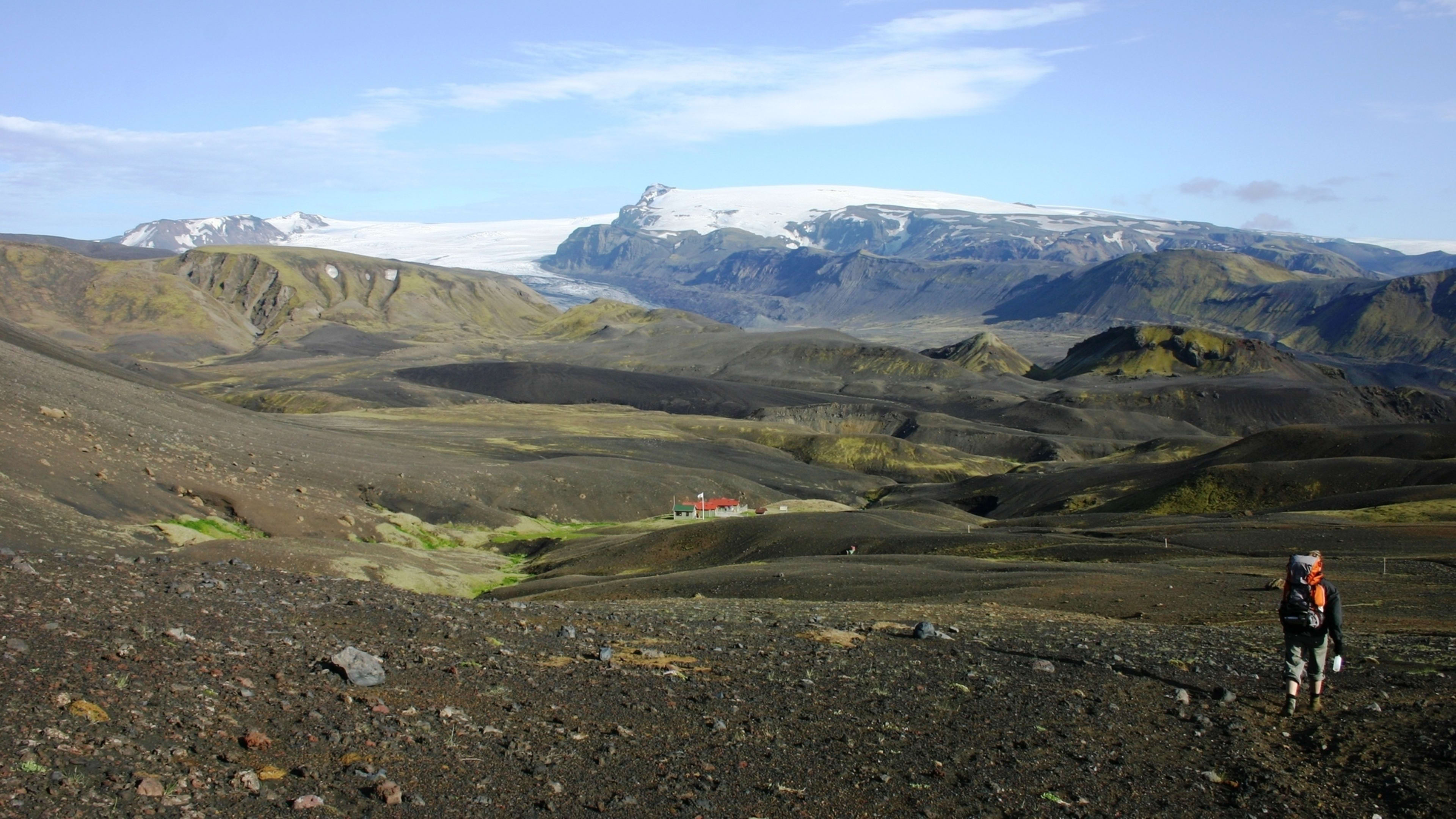
Þórsmörk ranks as one of Iceland's most popular hiking destinations, serving as both a destination in itself and a crucial junction for the country's most famous long-distance trails. The valley marks the southern endpoint of the legendary 55-kilometer Laugavegur Trail from Landmannalaugar and the northern terminus of the 25-kilometer Fimmvörðuháls Trail from Skógar. Many hikers combine these routes into a multi-day traverse of the southern highlands.
Beyond these famous long-distance routes, Þórsmörk offers countless shorter hiking options suitable for day visitors or those spending just a night or two in the valley. The Valahnúkur hike provides one of the area's most accessible yet rewarding experiences, with a relatively easy 220-meter ascent taking about 90 minutes to reach a summit viewpoint at approximately 1,000 meters elevation. From the top, hikers enjoy 360-degree panoramas encompassing the valleys, glaciers, rivers, and surrounding mountains.
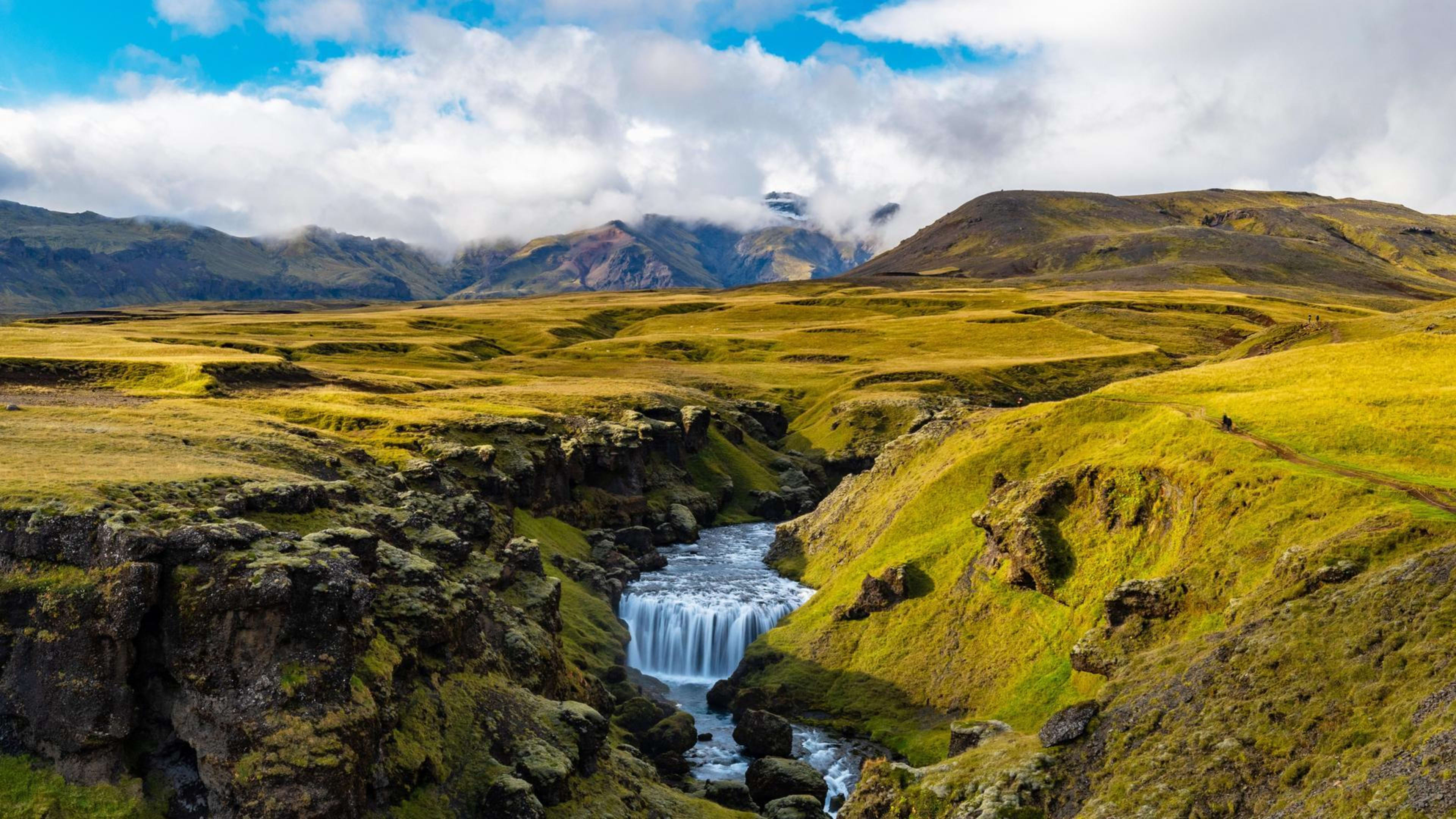
The Slyppugil ravine trail leads through lush greenery into a beautiful canyon with towering moss-covered walls, ending at a waterfall that cascades from a hidden crevice. The Réttarfell hike takes adventurers up to a ridge offering stunning views of Eyjafjallajökull and the Þórsmörk valley below. Each trail showcases different aspects of the valley's beauty, from intimate canyon walks to expansive mountain vistas.
Rivers and Glaciers
Three major rivers flow through the Þórsmörk region, defining its boundaries and creating both challenges and beauty. The Krossá winds through the valley like a ribbon, its glacial waters running cold and swift between the mountains. The Þröngá and Markarfljót rivers complete the triangle, their channels shifting and braiding across the black sand as meltwater volumes change with seasons and weather.
These rivers, fed continuously by the surrounding glaciers, create a dynamic landscape where channels shift, new paths form, and the sound of rushing water provides a constant soundtrack. During the 2010 eruption of Eyjafjallajökull, massive jökulhlaups, or glacial outburst floods, surged through the valley as volcanic heat rapidly melted glacial ice. The Gígjökull glacial lagoon, once one of Þórsmörk's gems, was destroyed during these floods, dramatically altering the landscape and demonstrating the powerful forces that continue to shape this region.
The glaciers themselves loom over the valley, their ice-covered peaks visible from most vantage points. Eyjafjallajökull, famous for its 2010 eruption that disrupted European air travel, rises to the west. Mýrdalsjökull, covering the dangerous Katla volcano, dominates the eastern horizon. Tindfjallajökull, less famous but equally impressive, stands to the north. The presence of these massive ice caps creates the protected climate that allows Þórsmörk's forests to thrive.
Access and Accommodation
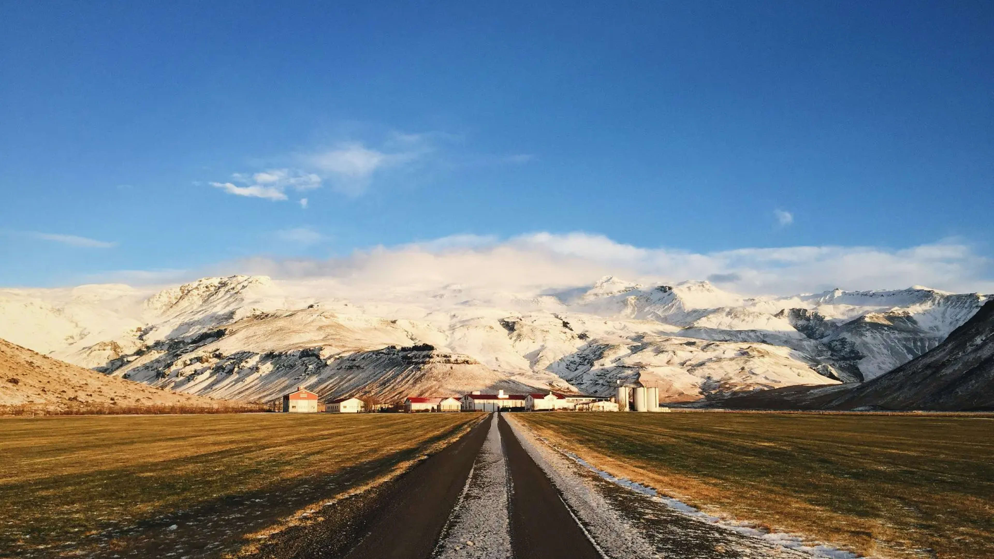
Reaching Þórsmörk requires commitment and proper planning. The valley is accessed via F249, a challenging mountain road featuring multiple unbridged river crossings, with Krossá representing the final and most dangerous obstacle. Most visitors wisely choose to park their vehicles before the river crossings and take specialized highland buses equipped to handle the deep, swift waters. These buses operate daily during summer from Reykjavík and other towns, providing safe and reliable access.
For hikers completing the Laugavegur Trail, arriving in Þórsmörk marks the end of several days of exposed highland terrain. The contrast between the barren lava landscapes further north and the birch-covered valley floor is noticeable.
Accommodation options in Þórsmörk include several mountain hut complexes. Langidalur hut, operated by the Icelandic Touring Association, can house up to 75 people across two floors with kitchens and dining areas. Básar huts, surrounded by birch trees, offer another option with modern facilities including showers and designated campsites. Volcano Huts at Húsadalur provide various accommodation styles from small cottages to glamping tents. All facilities operate during the summer season, typically from late May or early June through mid-September.
A Valley Shaped by Fire and Ice
The 2010 eruption of Eyjafjallajökull left lasting marks on Þórsmörk. Thick layers of volcanic ash covered the valley, taking considerable time to clear from trails and facilities. The eruption also created the Magni and Móði craters, named after two of Thor's sons in Norse mythology, the names meaning "brave" and "strong." These fresh volcanic features add to the valley's geological diversity, with black lava fields and volcanic ash contrasting against the green vegetation.
The valley's designation as a nature reserve, formalized after the 1918 eruption of Katla volcano, protects its unique ecosystems and landscapes. Part of the Katla UNESCO Global Geopark, Þórsmörk represents a crucial area for understanding the interaction between volcanic activity, glacial processes, and ecosystem development. Scientists study the valley to learn how vegetation recovers after volcanic disturbances and how glacial retreat affects highland environments.