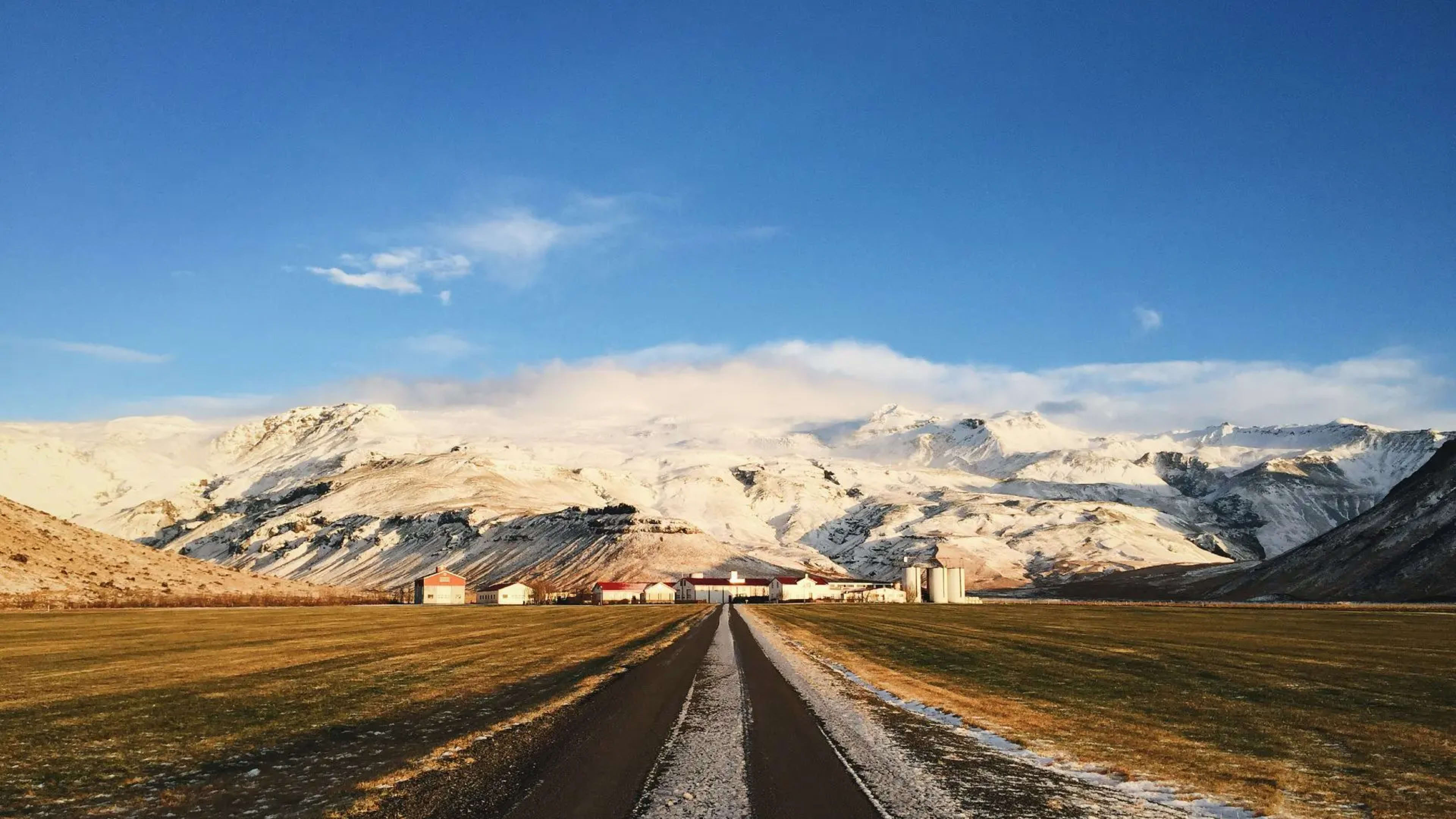
A Glacial River Through Thor's Valley
Krossá flows through the heart of Þórsmörk valley, winding between mountains and birch forests in one of Iceland's most beautiful highland regions. This glacial river, fed by meltwater from the surrounding ice caps including Mýrdalsjökull, Eyjafjallajökull, and Tindfjallajökull, runs cold and swift year-round, its waters carrying the distinctive gray-white color of suspended glacial sediment. The river's name and presence are central to the geography of Þórsmörk, defining boundaries and creating the challenges that have kept this valley relatively pristine despite its popularity.
The river stretches approximately 12.4 kilometers through the Þórsmörk region, dropping elevation as it flows from the glaciers toward its eventual meeting with other watercourses downstream. Its flow varies dramatically depending on weather conditions, glacial melt rates, and recent precipitation. During warm sunny periods, the river swells with increased meltwater from the glaciers, while cold or rainy weather can temporarily reduce flow before runoff from precipitation causes new surges.
Iceland's Most Notorious River Crossing
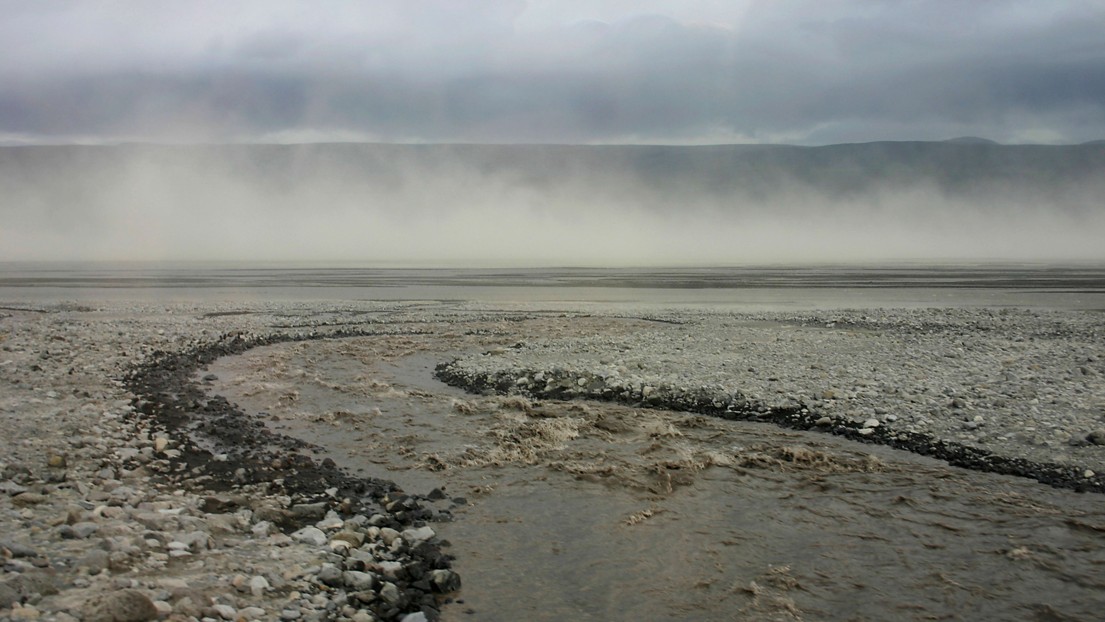
Krossá has earned a reputation as one of Iceland's most dangerous river crossings for vehicles, claiming numerous cars and trucks each year from drivers who underestimate its power. The river is deep, fast-flowing, and possesses an unstable riverbed that shifts regularly, making safe crossing points unpredictable. The current can be strong enough to sweep vehicles away, and the depth varies drastically across the river's width, with hidden deep channels waiting to trap unwary drivers.
Unlike some Icelandic rivers where experienced drivers in proper vehicles can safely ford during favorable conditions, Krossá is widely considered too dangerous for vehicle crossings even by locals and professional guides. The unpredictable nature of the river means that conditions that appear manageable at one moment can change within hours, and what seems like a shallow crossing point may conceal deep water just meters away. This has led to strong warnings from authorities, tour operators, and locals: do not attempt to drive across Krossá.
Many travelers attempting to reach the Volcano Huts or Langidalur campsite in Þórsmörk have learned this lesson the hard way, with vehicles becoming stuck, swept away, or suffering catastrophic water damage to engines and electronics. The costs of recovery and repairs often run into tens of thousands of dollars, and rental car insurance specifically excludes damage from river crossings. Beyond financial costs, failed crossings pose genuine safety risks to occupants.
The Pedestrian Bridge Solution
Recognizing both the danger of vehicle crossings and the importance of access to Þórsmörk, a mobile pedestrian footbridge is installed over Krossá during the summer hiking season. This bridge, typically positioned between the Langidalur and Básar huts approximately 30 kilometers up road F249, provides hikers safe passage across the glacial torrent. The footbridge has become an iconic part of the Laugavegur Trail experience, offering dramatic views of the river rushing beneath hikers' feet.
The bridge location can shift depending on river conditions and flood risks, and during severe flooding events it may be temporarily removed for safety. Hikers approaching the crossing sometimes must wade through shallow water to reach the bridge itself, though this is minor compared to the main river crossing. The Icelandic Touring Association and hut wardens provide current information about bridge status and safe crossing routes, which hikers should verify before attempting the crossing.
For Laugavegur Trail hikers completing their trek from Landmannalaugar, crossing the Krossá footbridge represents a significant milestone. The bridge marks entry into Þórsmörk proper, with its lush vegetation and protected valleys offering a stark contrast to the exposed highlands left behind. Many hikers report that stepping off the bridge into the green valley feels like entering a different world, with the shelter from wind and the presence of trees creating an almost magical atmosphere after days in barren landscapes.
Alternative Access to Þórsmörk
For those driving to Þórsmörk, the recommended approach is to park before the Krossá crossing and either walk across the pedestrian bridge or take one of the specialized highland buses that operate regular service to the valley. These buses, equipped with massive tires and high clearance, are designed specifically for Icelandic river crossings and driven by experienced professionals who know the rivers intimately.
Highland buses depart from multiple locations including Reykjavík, Hella, and designated parking areas along road 249. They provide safe, reliable access to Þórsmörk throughout the summer season, eliminating the stress and danger of river crossings. For independent travelers, parking is available near Brú Base, approximately 5 kilometers past Seljalandsfoss waterfall on road 249, where the bus makes regular pickups.
Another option is the "Krossá taxi" service operated by the Volcano Huts, which can transport visitors across the river for a fee. This service requires calling ahead and coordination with the hut staff, but provides a solution for those who have driven partway up F249 and need assistance with the final crossing. Super jeep tours offer yet another alternative, with specially modified vehicles capable of handling the crossing when driven by experienced guides who understand the river's moods and dangers.
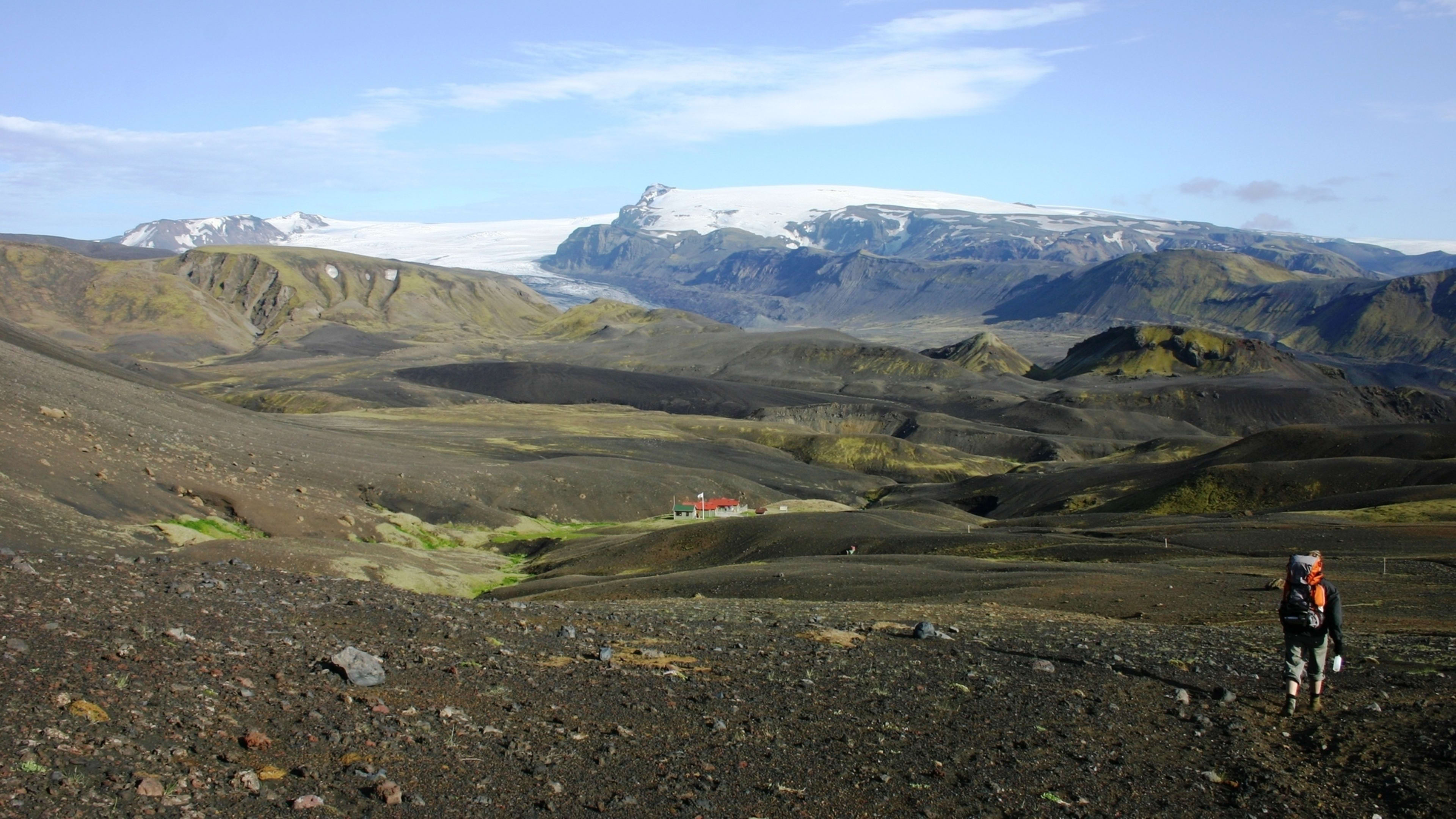
A River in a Protected Valley
The Krossá flows through the Þórsmörk Nature Reserve, an area characterized by unusually warm microclimates created by the valley's protected position between glaciers. The shelter from prevailing winds and the moderating influence of the surrounding ice caps create conditions where vegetation thrives more abundantly than in most highland areas. Arctic birch forests grow along the riverbanks, with moss, ferns, and small shrubs creating verdant corridors that follow the watercourse.
The river supports fish populations, most notably salmon, making Krossá a destination for anglers despite its remote location. The river features 44 marked fishing pools, with the fishing season running from July 1st to September 25th. The quota is limited to 4 salmon per day per rod, reflecting both conservation efforts and the river's smaller size compared to Iceland's major salmon rivers. The average catch over five-year periods has been approximately 245 salmon, demonstrating healthy fish populations in this glacial system.
The presence of fish in such a harsh glacial river demonstrates the resilience of life in Iceland's waterways. Salmon must navigate strong currents and cold temperatures, migrating from the ocean up through multiple river systems to reach their spawning grounds. The fact that they successfully reproduce in Krossá and similar glacial rivers speaks to the productivity of these ecosystems despite their challenging conditions.
Part of the Þórsmörk Experience
For hikers completing the Laugavegur Trail, Krossá represents more than just an obstacle to be crossed. The river embodies the wild character of Þórsmörk, a place where nature's power remains evident and human presence feels temporary. The sound of the river rushing through the valley provides a constant backdrop to activities in the area, whether hiking the numerous trails, relaxing at the mountain huts, or exploring the unique ecosystem that thrives in this protected environment.
The valley's beauty stems partly from the very inaccessibility that Krossá creates. The challenging river crossings on F249, culminating in Krossá itself, have limited development and kept visitor numbers manageable despite Þórsmörk's popularity. This has preserved the wilderness character that makes the valley so special, ensuring that those who make the effort to reach it find a landscape that feels genuinely remote despite being a relatively short distance from the Ring Road.