A Geothermal Wonderland in the Highlands
Jökultungur is a spectacular geothermal valley nestled in Iceland's southern highlands between Hrafntinnusker and Álftavatn. The name, which translates roughly to "glacier tongue" or "ice tongue gully," reflects the area's position in a landscape where geothermal activity and glacial features exist in remarkable proximity. This extraordinary valley showcases the raw power of Iceland's volcanic forces through hundreds of steaming hot springs and bubbling mud pools.
The valley forms a crucial section of the famous Laugavegur Trail, representing one of the most geothermally active areas hikers encounter on their journey from Landmannalaugar to Þórsmörk. As trekkers descend from the exposed heights of Hrafntinnusker into the protected gullies of Jökultungur, they enter a world transformed by heat rising from deep within the Earth.
Painted by Geothermal Forces
What makes Jökultungur truly unforgettable is its extraordinary palette of colors. Over countless years, geothermal activity has painted the gullies in vivid shades of yellow, orange, and red, creating a landscape that seems almost impossibly vibrant. These brilliant colors come from sulfur deposits and mineral-rich waters that have stained the rocks and soil, creating patterns and textures that shift with changes in light and weather.
The contrast between these warm mineral tones and the pale sand-colored peaks surrounding the valley creates a visual spectacle unlike anywhere else on the trail. Steam rises continuously from countless vents and hot springs, adding an ethereal quality to the landscape. On cooler days or in morning light, the valley can be filled with wisps of steam that drift through the gullies, creating an otherworldly atmosphere.
Hundreds of hot springs dot the valley floor, some gently bubbling, others vigorously boiling. Mud pools gurgle and pop, their surfaces constantly shifting and changing. The ground itself is warm in many places, a reminder of the intense heat just below the surface. Despite the harsh conditions created by this geothermal activity, hardy vegetation manages to establish itself in protected spots, adding patches of green to the mineral palette.
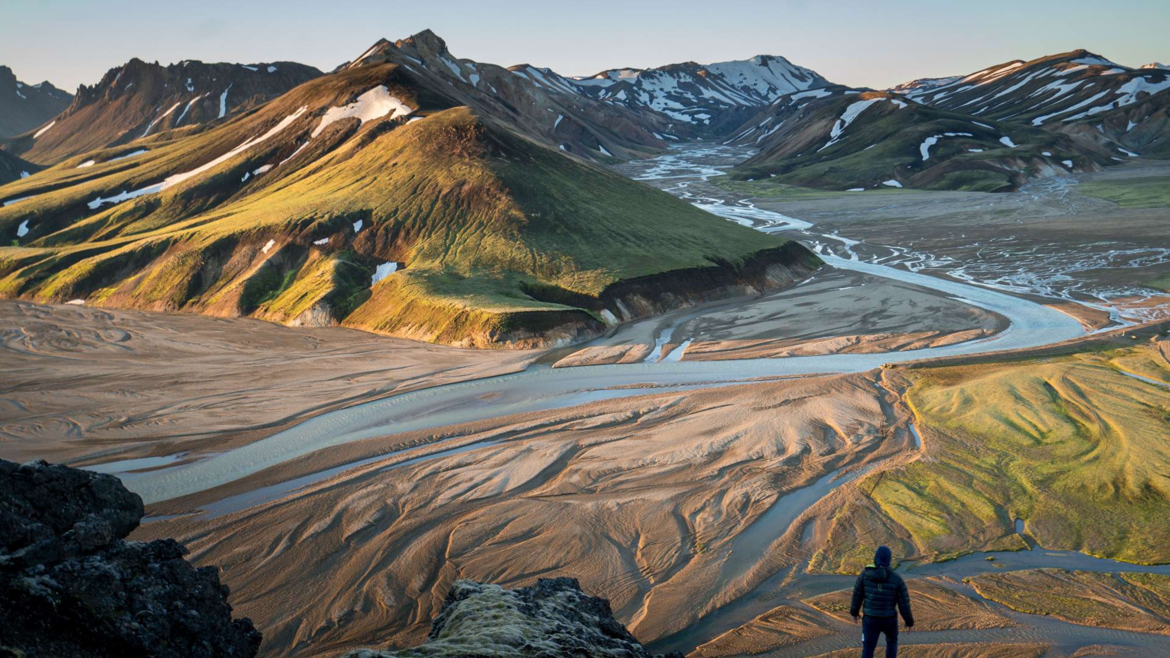
Gateway to Spectacular Views
From the higher points of Jökultungur, hikers are treated to expansive views across the Fjallabak region. On clear days, the massive ice caps of Mýrdalsjökull, Eyjafjallajökull, and Tindfjallajökull glaciers can be seen to the south, their white peaks contrasting dramatically with the dark volcanic plains below. These views provide perspective on the scale of Iceland's glacial systems and the volcanic landscape that defines the highlands.
The valley sits at a transitional point along the Laugavegur Trail, where the stark obsidian deserts and exposed heights of Hrafntinnusker give way to more varied terrain. As hikers continue south toward Álftavatn, the landscape gradually becomes more hospitable, though Jökultungur itself remains wild and unforgiving.
Hiking Through Jökultungur
Most hikers experience Jökultungur as part of the second day on the Laugavegur Trail, typically covering the 12 to 16 kilometer stretch from Hrafntinnusker to Álftavatn. The descent into the valley provides welcome relief after the exposed and often windy conditions at Hrafntinnusker, though caution is still necessary when navigating around geothermal features.
The trail through Jökultungur follows well-marked paths, but hikers must pay close attention to trail markers, especially in poor visibility. Snow can linger in the gullies well into summer, creating unstable snow bridges that must be crossed carefully. The geothermal heat can create thin spots in the snow that are not always visible, making it essential to follow established routes rather than venturing off-trail.
Walking through the valley requires time and attention. The constantly changing scenery, from steaming vents to colorful mineral deposits to dramatic views of surrounding peaks, demands frequent stops for photography and simply taking in the remarkable environment. Many hikers find this section of the trail to be among the most memorable of the entire trek.
Visiting Jökultungur
Access to Jökultungur is almost exclusively via the Laugavegur Trail, as part of a multi-day hiking trek through the highlands. The valley is not accessible by vehicle and sits far from any roads or settlements. This remoteness is part of its appeal, offering hikers a genuine wilderness experience in one of Iceland's most geologically active regions.
The hiking season runs from late June through early September, with conditions varying significantly throughout this period. Early season hikers will encounter more snow in the gullies, while late season visitors may find drier conditions but also face the possibility of early winter storms. Regardless of timing, hikers should be prepared for rapidly changing weather, including wind, rain, and cold temperatures even in mid-summer.
Safety around geothermal features is paramount. The heat from hot springs and steam vents can cause severe burns, and the ground around these features can be unstable. Hikers should stay on marked trails and exercise extreme caution when near any geothermal activity. The vibrant colors that make Jökultungur so beautiful also serve as warning signs of the intense heat present just below the surface.