


About Jökulsárgljúfur
Jökulsárgljúfur is a 25 km canyon in the northernmost section of Vatnajökull National Park, carved by the Jökulsá á Fjöllum river as it flows south from Vatnajökull glacier. The name means "glacial river canyon." It reaches depths of up to 120 metres and contains some of north Iceland's most varied and dramatic scenery -- powerful waterfalls, distinctive rock formations, and the horseshoe canyon of Ásbyrgi at its northern end.
The canyon was not carved gradually. It was formed by catastrophic glacial outburst floods -- jökulhlaups -- triggered by volcanic eruptions beneath the glacier. These floods moved at enormous volumes and with sufficient force to carve through solid bedrock, with multiple events over thousands of years creating the stepped canyon system visible today. The river continues to shape the landscape, though at a far slower pace.
Jökulsárgljúfur was its own national park until 2008, when it merged with the wider Vatnajökull National Park.
What to see
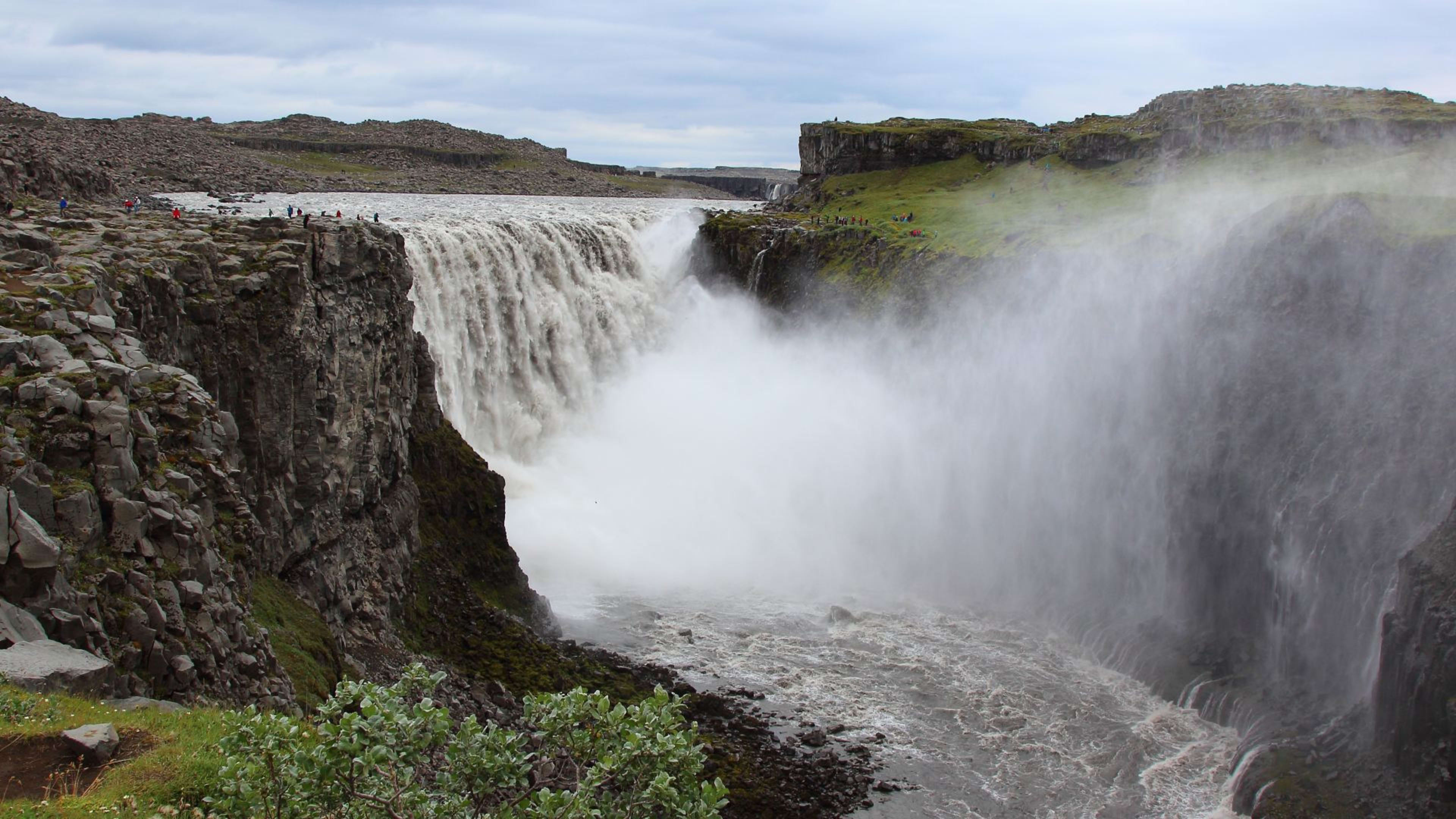
Dettifoss and the waterfalls
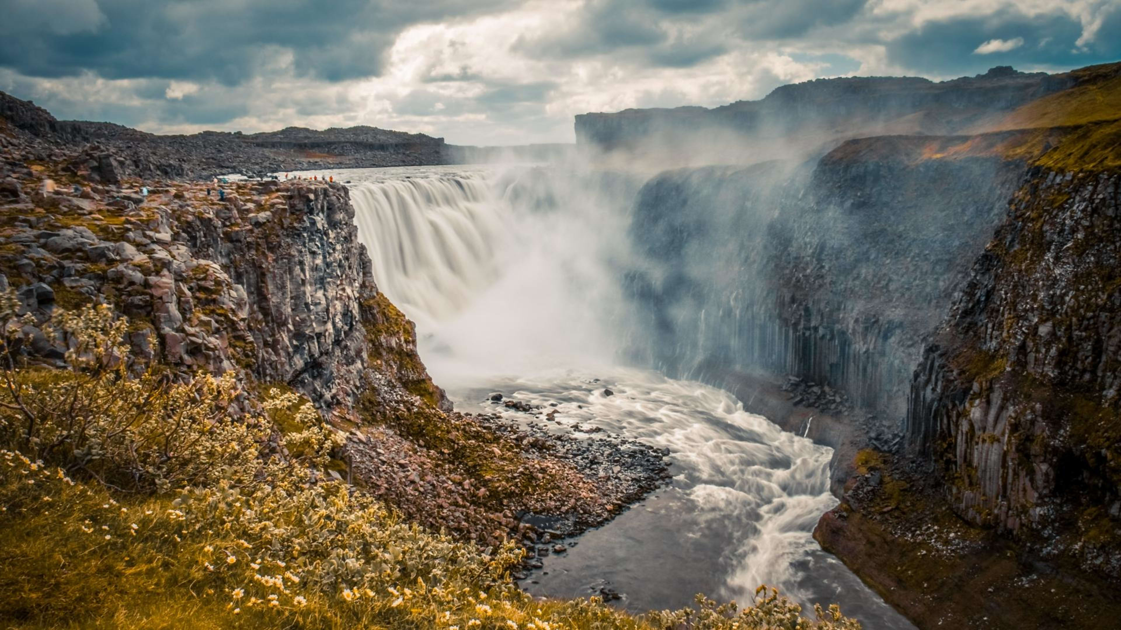
Dettifoss is the canyon's most visited site -- the second most powerful waterfall in Europe by volume, dropping 44 metres over a width of around 100 metres. It is accessible from both sides of the canyon via Routes 862 and 864. About 1 km upstream, Selfoss spreads across multiple rocky tiers at 11 metres high. Hafragilsfoss, 2 km downstream from Dettifoss, drops 27 metres into a narrower section of the canyon. The three waterfalls can be combined in a half-day walk from either access road.
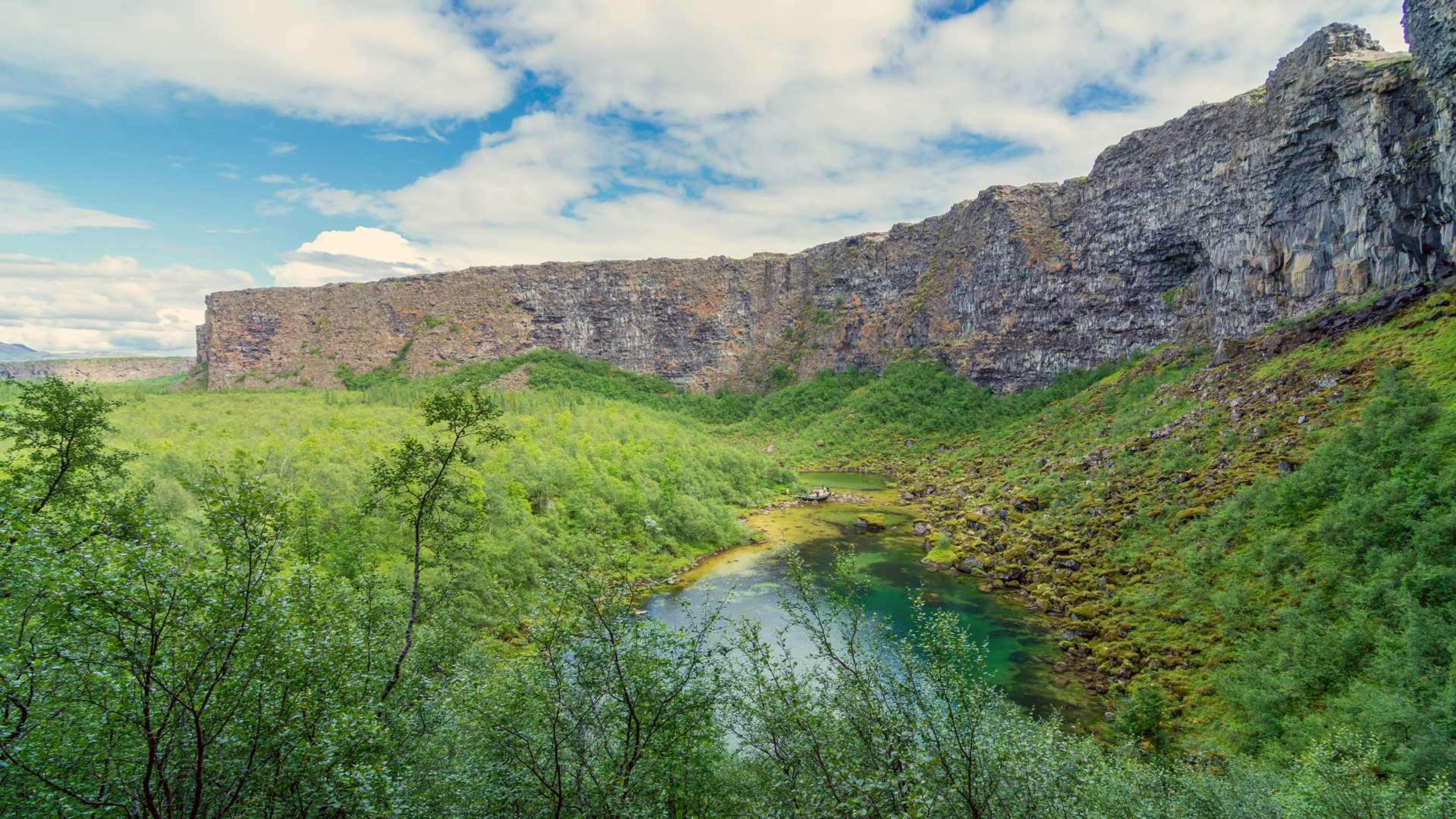
Ásbyrgi
At the northern end of the canyon, Ásbyrgi is a 3.5 km horseshoe-shaped depression enclosed by walls up to 100 metres high. The floor of the canyon is sheltered and unusually lush by Icelandic standards, with birch woodland and a small lake. Icelandic legend holds that Ásbyrgi was formed by the hoofprint of Óðinn's eight-legged horse Sleipnir. Geologically, it was most likely shaped by a catastrophic flood event. The Gljúfrastofa visitor centre near Ásbyrgi provides trail maps, current conditions, and information about the canyon's geology.
Hljóðaklettar
Between Ásbyrgi and Dettifoss, the Hljóðaklettar rock formations -- "echo rocks" -- are an unusual cluster of columnar basalt structures that create natural acoustic chambers. The name refers to the sound effects produced by the formations, and the area is popular with those interested in geology and photography.
Hiking
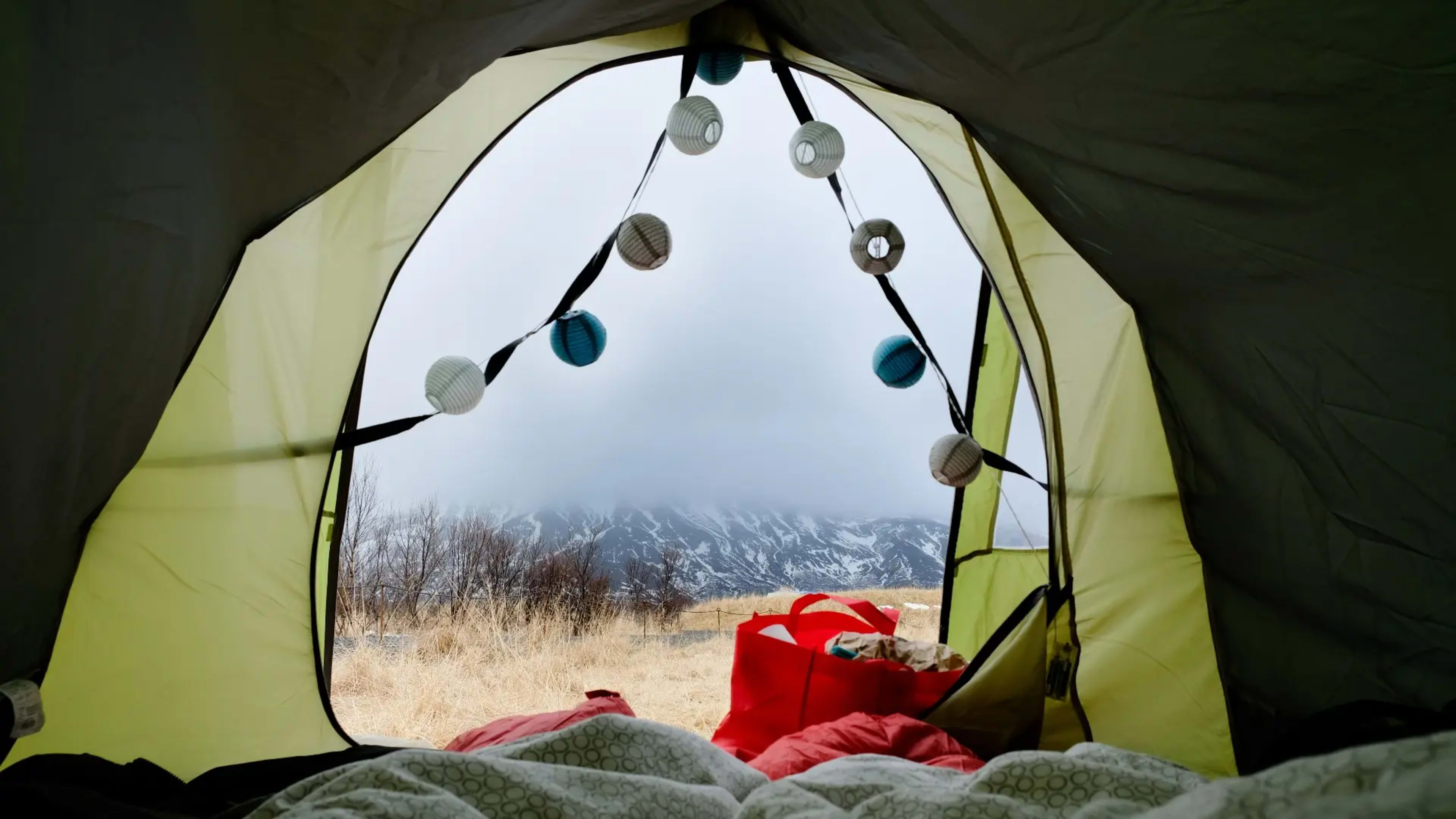
A 32 km trail runs the full length of the canyon from Ásbyrgi to Dettifoss, taking two to three days for most walkers. Designated camping areas are spaced along the route. Day hiking options are available from both the Ásbyrgi end and the Dettifoss access points, with trails ranging from easy walks on the canyon floor to more exposed rim paths.
Getting there
The northern entrance near Ásbyrgi is reached via Route 85. Dettifoss is accessible from the east via Route 864 (gravel, seasonal) or the west via Route 862 (paved, open year-round). Akureyri is the nearest large town, about 1.5 hours west. Lake Mývatn is around 45 minutes southwest and makes a natural base for exploring the canyon.