When visiting Iceland, glaciers are something you’ll see almost by accident! Just over a tenth of the country is covered in them, meaning there are plenty of ice-capped mountaintops to see. You’ll also see huge stretches of ice extending from outlet glaciers.
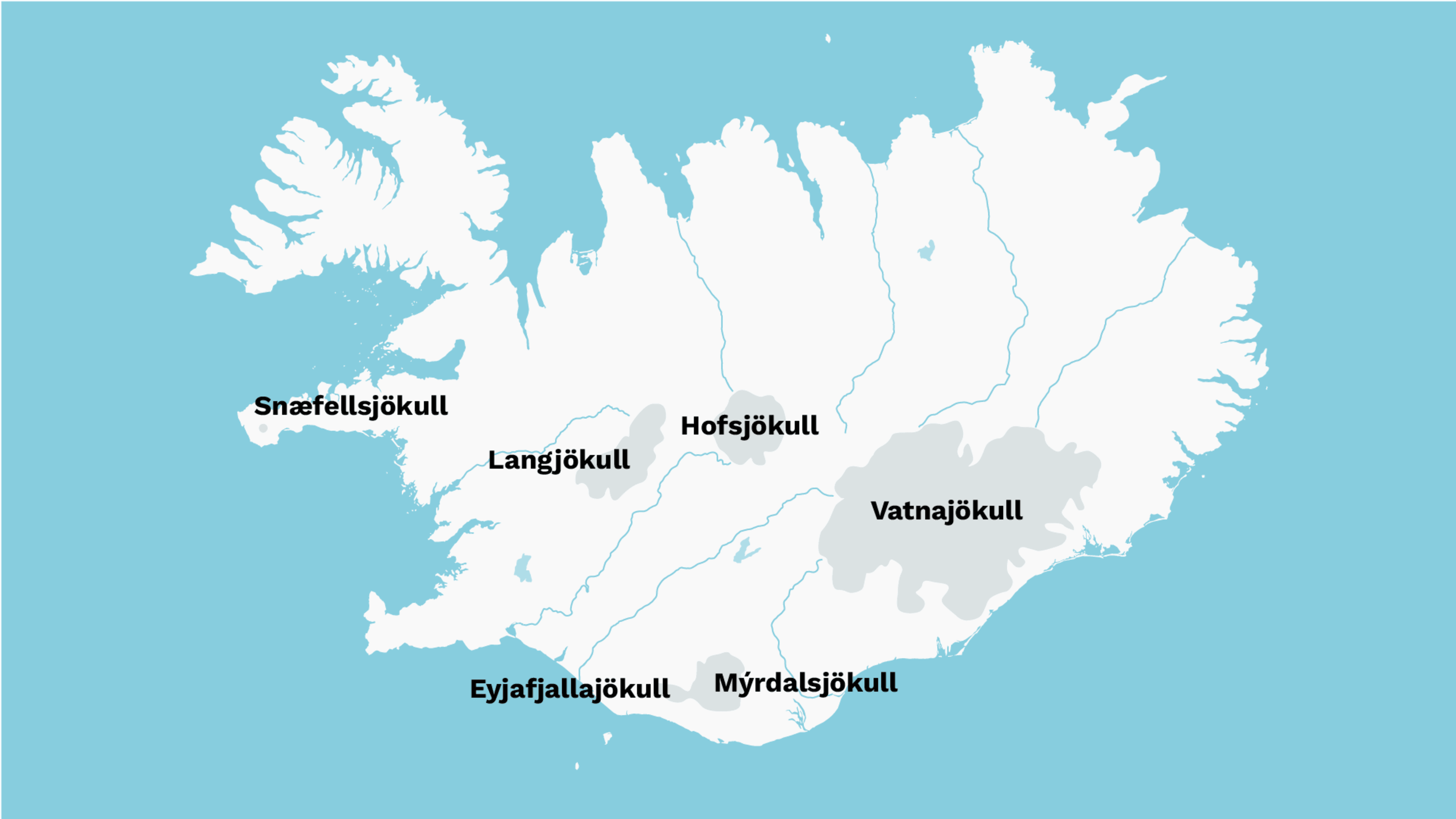
So where’s the best place to see a glacier in Iceland? They are mostly concentrated in the southern half of the country, in a crescent from the Snæfellsnes peninsula in the west to Vatnajökull glacier in the southeast.
- Get up close to a glacier on one of these adventure tours of Iceland.
Read on and find out about more about how they were formed and which ones are the best to visit.
Hint: The Icelandic word for ‘glacier’ is jökull and features in the name of almost every one in the country!
Where are the glaciers in Iceland?
You’ll find the majority of Iceland’s glaciers, including its largest, in central or south Iceland. The reason for this is not to do with temperature, but the fact that there is more snowfall in those parts of the country.
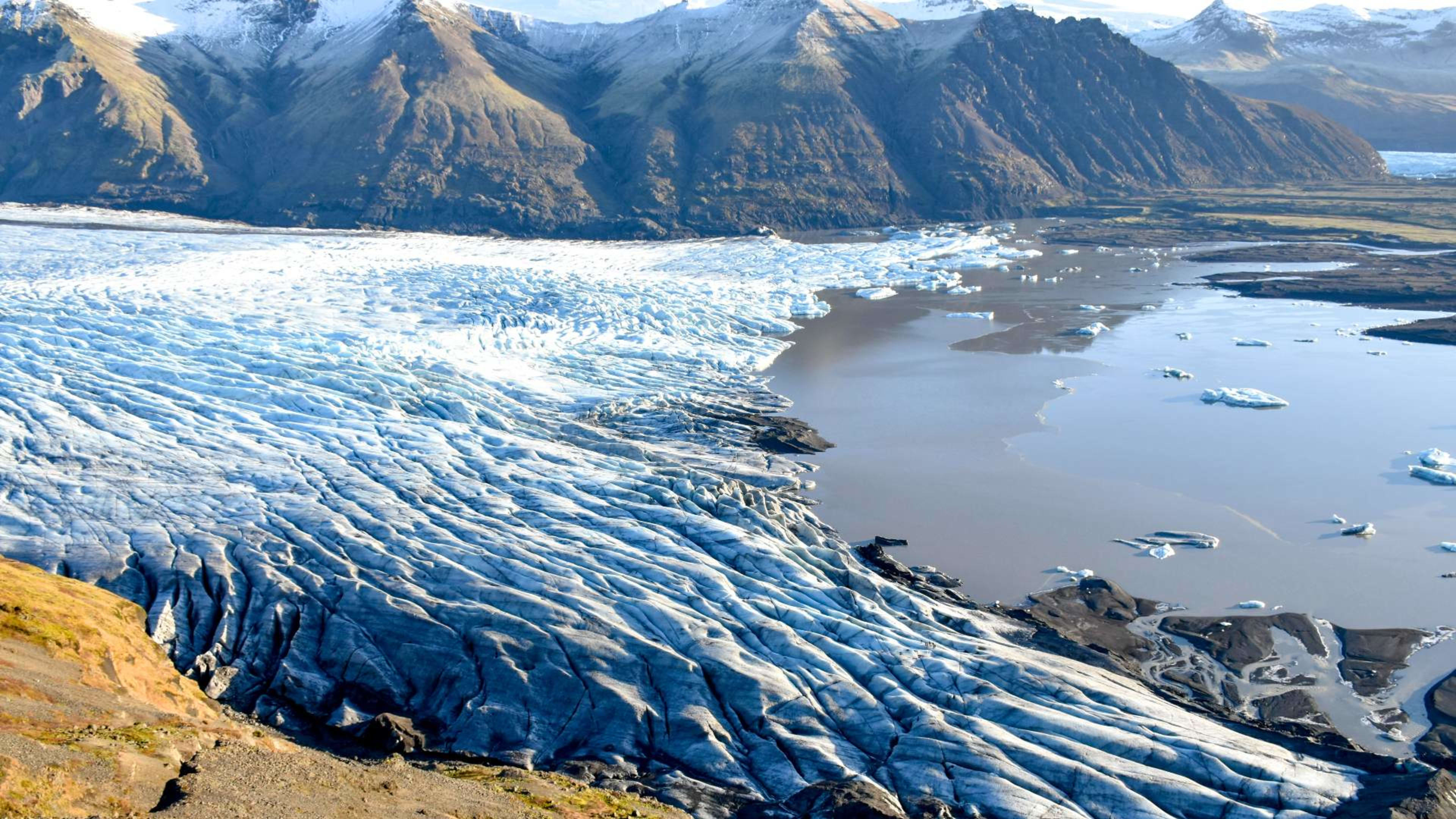
Vatnajökull, which is the biggest glacier in Iceland, stretches all the way from the central highlands to the south coast. One of its outlets empties into Jökulsárlón glacier lagoon, where you can see baby icebergs calving off before floating out to sea.
The largest glacier in the north is Drangajökull in the Westfjords. It’s also the fifth largest in the country.
How many glaciers are there in Iceland?
It’s impossible to put an exact figure on it, but there are at least 13 large glaciers in Iceland. In order of size from largest to smallest, they are:
- Vatnajökull
- Langjökull
- Hofsjökull
- Mýrdalsjökull
- Drangajökull
- Eyjafjallajökull
- Tungnafellsjökull
- Þórisjökull
- Eiríksjökull
- Þrándarjökull
- Tindfjallajökull
- Torfajökull
- Snæfellsjökull
As well as these, you’ll find there are hundreds of smaller glaciers around the country, some only a few square meters in size.
Iceland glacier map
You can see the main glaciers we’ll cover in this blog post on a map:
How much of Iceland is covered by glaciers?
11,400 km² (4,400 sq mi), is covered by glaciers. This is around 11% of Iceland’s total land area. You can spot them pretty easily on any map or satellite image of the country. They’re the big white splotches (or gray on the map above)!
At the end of the last ice age, Iceland was almost entirely covered in glaciers. The ice would have joined Iceland up to the Arctic and British Isles. The glaciers that you can see today are the last remnants of this ginormous ice cap.
Are Iceland’s glaciers melting?
Unfortunately, yes. Due to the rise in temperature caused by climate change, the country’s glaciers are gradually receding. In fact, one of the smallest, Okjökull, disappeared altogether in 2014. That said, you can still see other glaciers in all of their glory today.
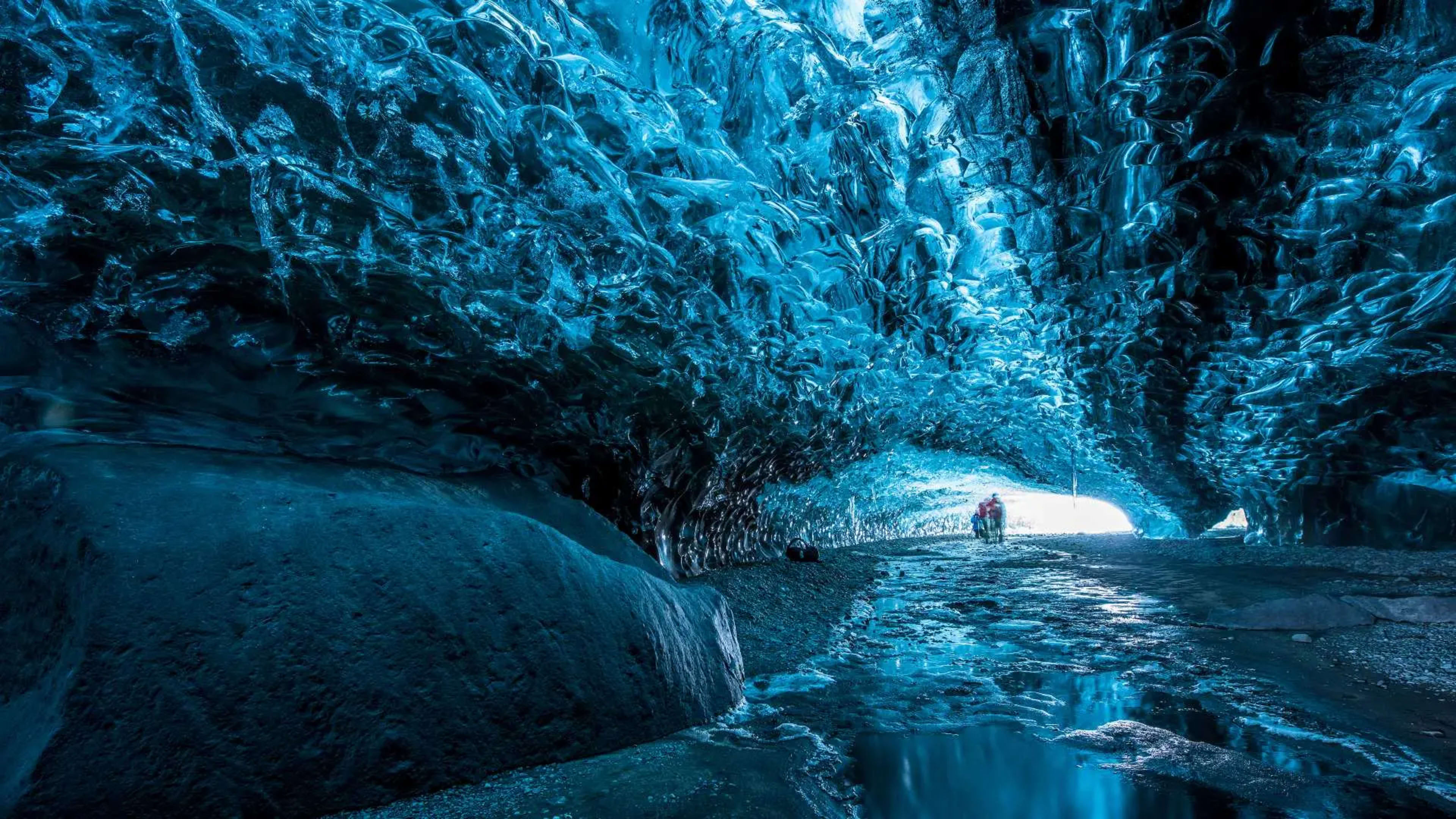
It’s normal for sections of glaciers to melt on a seasonal basis. In the springtime, the meltwater left behind by the glacier ice carves out spectacular ice caves underneath Langjökull and Vatnajökull.
- Walk under a glacier yourself on an ice cave tour in Iceland.
- Related: Guide to ice caves and lava caves in Iceland.
And because Iceland’s glaciers contain the equivalent of 20 times the annual precipitation the country receives, they’re an important source of freshwater.
As it happens, the glaciers feed many of Iceland’s waterfalls, including Gullfoss, Seljalandsfoss, and Skógafoss. You can see how much of an effect they have by visiting these waterfalls in the summer months during the seasonal melt.
In wintertime, the glaciers freeze solid once again. And they’re topped up with fresh snowfall, which becomes gradually compressed and turns to solid ice over the years.
Can I visit a glacier in Iceland?
Absolutely! One important thing is though that you shouldn’t attempt to visit a glacier by yourself. Always go on an organized trip with a trained and experienced guide, like those offered by Iceland Tours.
The surface of a glacier is constantly changing and there can be hidden dangers. So it’s vital that you go with a qualified guide who can ensure you have a safe and fun time on the glacier!
Best glaciers to visit in Iceland
1. Vatnajökull
Area: 7,900 km² (3,050 sq mi)
Location: Southeast Iceland
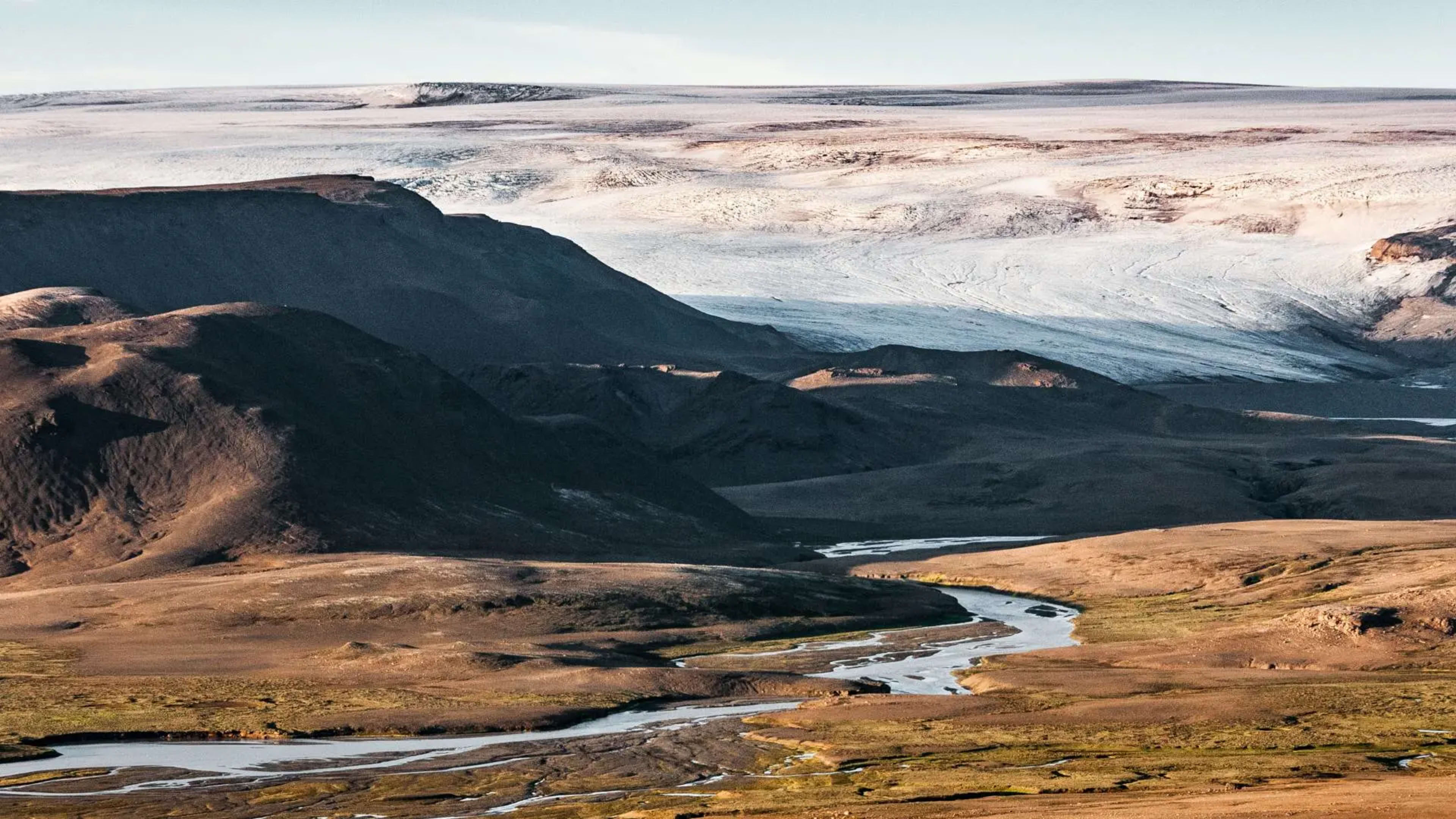
Vatnajökull is by far the largest glacier in Iceland. This beast alone covers 8% of the country (bear in mind that all of Iceland’s glaciers combined cover 11%). So if you’re driving anywhere along the southeast coast, Vatnajökull will likely be towering over you.
As with lots of Iceland’s glaciers, Vatnajökull hides active volcanoes. The most lively of these is Grímsvötn, which last erupted in 2011. Because the volcano lies beneath the ice, when it erupts it causes outburst floods known in Icelandic as jökulhlaup.
Other volcanoes under the glacier include Bárðarbunga (last eruption: 2014–15) and Öræfajökull (last eruption: 1728).
Jökulsárlón glacier lagoon
The Vatnajökull ice cap has dozens of valley glaciers that empty into different rivers. One of the most important is Breiðamerkurjökull, which stretches into the Jökulsárlón lagoon. This glacial lake is teeming with icebergs large and small that have broken off the glacier.
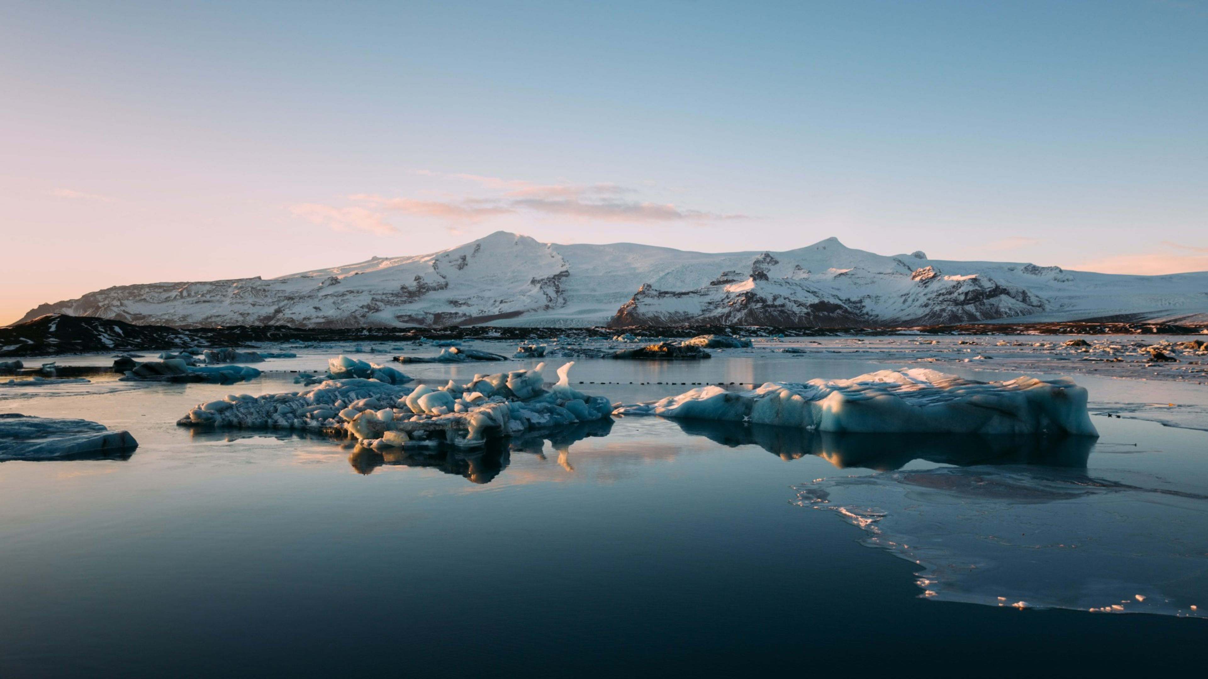
You can access Jökulsárlón easily from the Ring Road, which actually passes over the lagoon via a bridge. And because the lagoon connects to the North Atlantic, you can watch the icebergs drift out to sea from here.
- Why not set off on an Iceland Ring Road trip of your own?
- Blog: Ultimate guide to driving Iceland’s Ring Road.
Some icebergs are even washed ashore on the nearby Fellsfjara (aka Diamond Beach). This creates a magical effect as the blue ice contrasts with the pitch-black volcanic sand.
2. Mýrdalsjökull
Area: 560 km² (215 sq mi)
Location: South Iceland
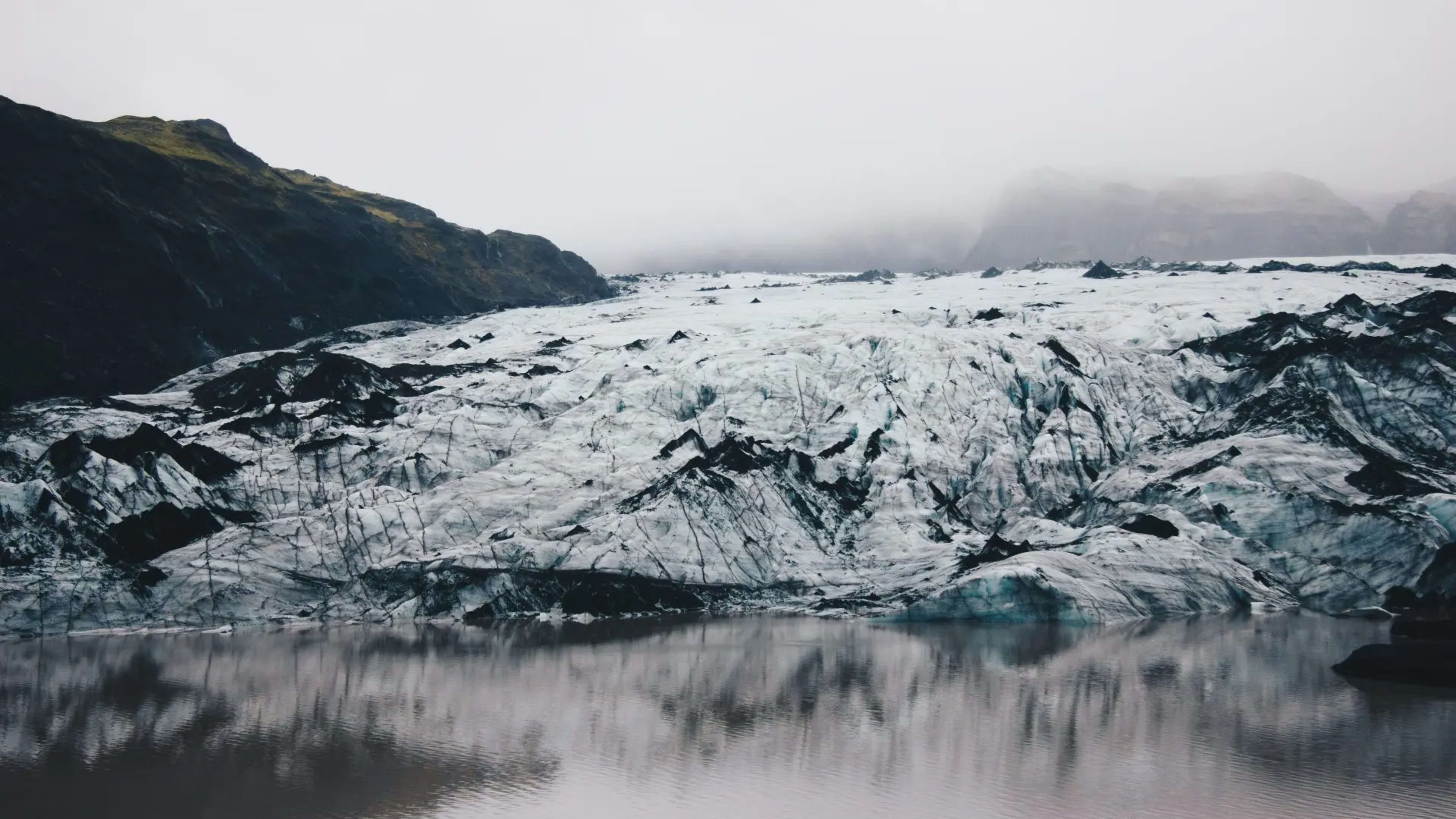
Mýrdalsjökull is the southernmost glacier in Iceland, not far from the village of Vík. It covers Katla, the largest active volcano in Iceland. Although it hasn’t properly erupted since 1918, it’s considered to be one of the most active volcanoes in the country.
You can see the mark of past volcanic eruptions on the glacier in the form of layers of ash. This black grit settles on top of the ice and is quickly covered in snow. But if you enter an ice cave and see black veins in the ice, what you’re looking at is volcanic ash. Like the rings of a tree, they tell us more about the history of a glacier.
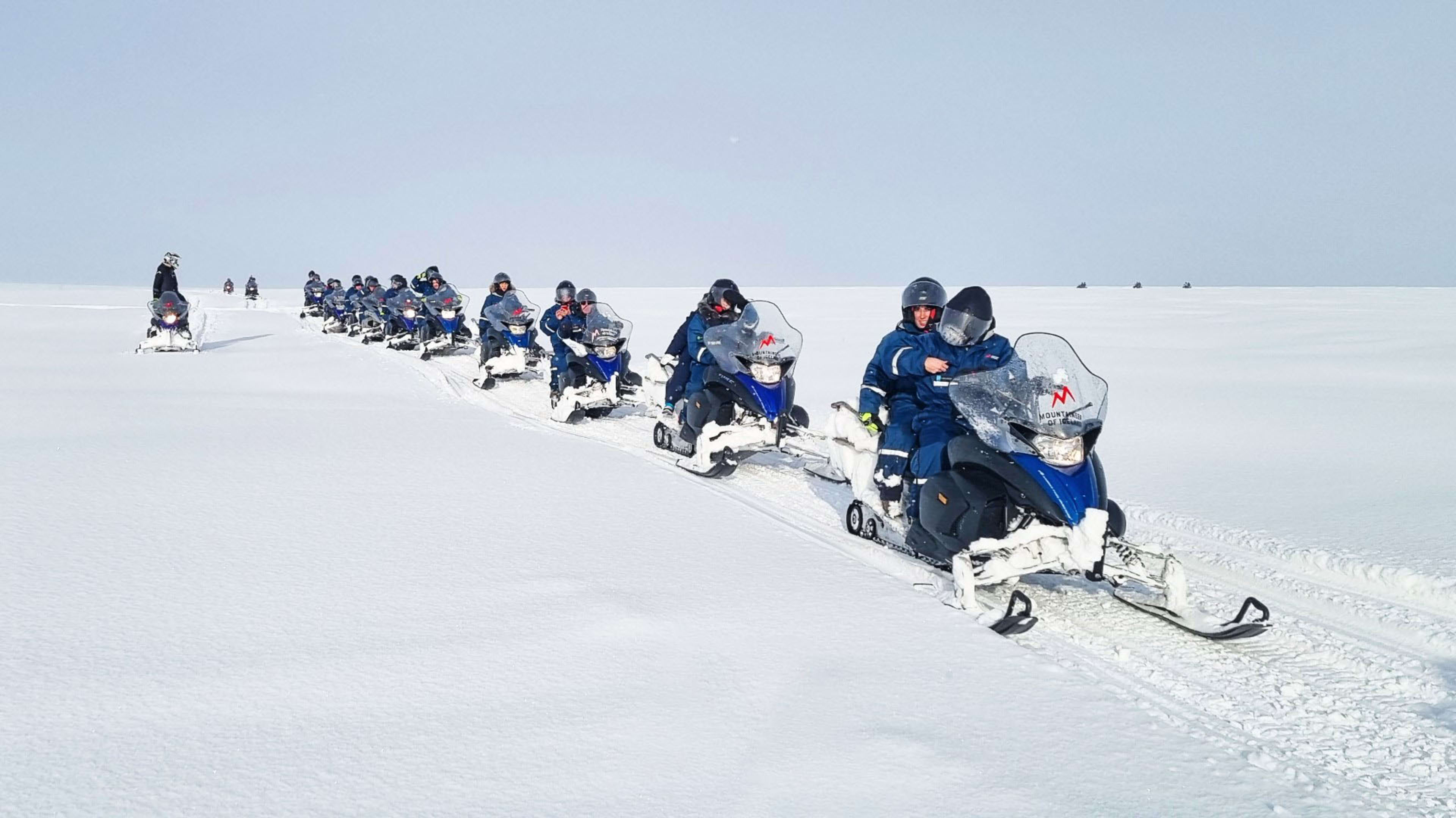
The Mýrdalsjökull glacier itself is a popular spot for adventure activities like snowmobiling tours and glacier hiking, especially on the Sólheimajökull outlet.
- Take a multi-day tour from Reykjavík and join the fun on Mýrdalsjökull.
3. Langjökull
Area: 900 km² (350 sq mi)
Location: West Iceland
Langjökull means ‘Long Glacier’. Look at a map and it’s easy to see why, it’s much longer than it is wide. If you venture to the Golden Circle and stop off at the Gullfoss waterfall, you’ll catch a glimpse of Langjökull in the distance.
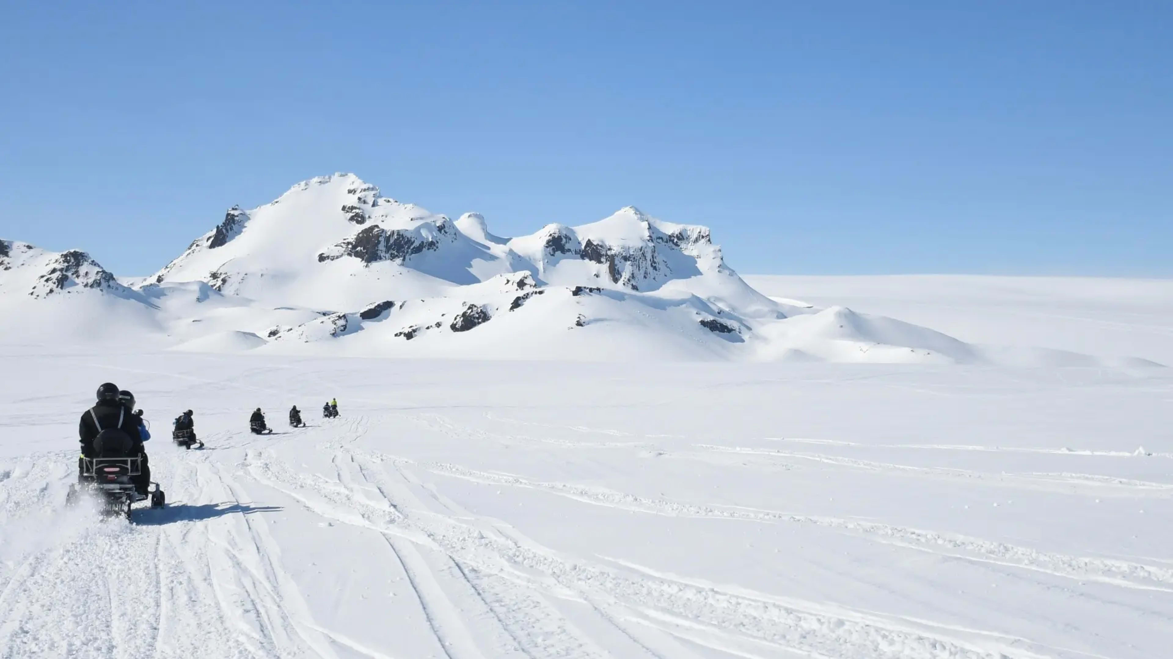
Thanks to its location near the Golden Circle, Langjökull is another great spot for glacier-based adventures. Here you can join a glacier hike, go snowmobiling, or take a glacier jeep tour on top of the glacier itself.
Once you’re up on the glacier surface, you can follow a trained guide and explore one of the dozens of ice caves that form under Langjökull every year!
- Check out these day trips for a full selection of ice-focused adventures.
4. Eyjafjallajökull

Area: 78 km² (30 sq mi)
Location: South Iceland
If there’s one glacier in Iceland you might have heard of before, it’s Eyjafjallajökull. Newsreaders across the world mangled the pronunciation of this glacier when the volcano beneath it started erupting in 2010.
- See Eyjafjallajökull and more on a self-drive trip to Iceland.
- Get the lowdown on Iceland’s volcanoes with this guide.
So let’s get this out of the way first: you pronounce it EY-ya-fyat-la-yoekut-l. Or at least, that’s the best way we can write it using English spelling. YouTube has loads of videos teaching you how to pronounce it if you want something more precise!
Tongue twisters aside, Eyjafjallajökull is one South Iceland’s most stand-out glaciers. It’s easily visible from the Ring Road as you drive south to Seljalandsfoss. And on a clear day, it can even be seen from the Westman Islands off the south coast.
Eyjafjallajökull is super close to its bigger brother Mýrdalsjökull. In fact, they’re connected by the Fimmvörðuháls mountain pass. This is actually the spot where the infamous eruption started back in 2010.
5. Snæfellsjökull

Area: 11 km² (4 sq mi)
Location: Snæfellsnes peninsula, West Iceland
Although it’s the smallest of Iceland’s main glaciers, Snæfellsjökull is still a stunning sight. Located at the far western end of the Snæfellsnes peninsula, the glacier sits within its very own national park.
Snæfellsjökull caps an active volcano, the only one on the whole peninsula. Despite being labeled as ‘active’, it hasn’t actually erupted for almost 2,000 years.
This was the volcano that served as inspiration for Jules Verne. In his iconic novel Journey to the Center of the Earth, the main character uncovers a passage leading to the Earth’s core underneath Snæfellsjökull.
On a clear day, the glacier is easily visible from Reykjavík. And in the summer, you can climb the mountain below Snæfellsjökull, although you shouldn’t hike on the actual glacier by yourself.
6. Hofsjökull
Area: 890 km² (345 sq mi)
Location: Central highlands
Up in the Icelandic highlands you’ll find Hofsjökull, Iceland’s third-largest glacier. Beneath the ice is a large and active volcanic system, although no one knows quite when it last erupted.
Because of its location, Hofsjökull is only accessible in the summer when the mountain roads (known as F-roads) are open. This part of Iceland experiences such harsh weather conditions in the wintertime that it is completely cut off from the rest of the country.
In the summer though, it’s safe for you to visit the highlands in a 4×4. There’s plenty to see there in fact, including the Landmannalaugar hot springs. If you’re feeling ambitious, you can even drive the Kjölur road which runs all the way up the country from south to north.
Planning your Iceland glacier trip
As we’ve seen, you don’t have to go far (or be a pro mountain climber!) to experience glaciers in Iceland. On an adventure tour of Iceland, you can join a group tour where you could:
- Go glacier hiking on Langjökull or Mýrdalsjökull
- Cross the glacier surface by snowmobile
- Explore a bright blue ice cave
On any of these activities, you’ll be led by a qualified and experienced guide. Plus, you’ll get all the gear you need to stay safe and comfy.
When you book an adventure package with Iceland Tours, you’ll get one or more ice-based experience included. And your accommodation and transport is all set up for you. All you need to do is book your flights and enjoy your trip.
And with just a 5% deposit, there’s no need to put your plans on ice, you can book today!